
+977-9709047652
Explore by Country
See all 22 Thailand packages
Most popular pick
See all 22 Thailand packages →
See all 11 Vietnam packages
Most popular pick
See all 11 Vietnam packages →
See all 10 Indonesia (Bali) packages
Most popular pick
See all 10 Indonesia (Bali) packages →
See all 7 Maldives packages
Most popular pick
See all 7 Maldives packages →
See all 10 China packages
Most popular pick
See all 10 China packages →
See all 13 Sri Lanka packages
Most popular pick
See all 13 Sri Lanka packages →
See all 9 Malaysia packages
Most popular pick
See all 9 Malaysia packages →
See all 8 Singapore packages
Most popular pick
See all 8 Singapore packages →
See all 2 Kenya packages
Most popular pick
See all 2 Kenya packages →
See all 16 India packages
Most popular pick
See all 16 India packages →
See all 3 Dubai packages
Most popular pick
See all 3 Dubai packages →
See all 7 Nepal packages
Most popular pick
See all 7 Nepal packages →
See all 6 Philippines packages
Most popular pick
See all 6 Philippines packages →
Search Tours or Places
Blog / Nepal

Mustang by Road: Jomsom, Muktinath and Lo Manthang

17 min read 09 Oct 2026
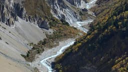
Jeep road through the Kali Gandaki valley in Mustang, Nepal, on the way to Jomsom and Muktinath

Short answer: you can drive all the way from Kathmandu to Muktinath. The road runs to Pokhara, then Beni, Tatopani and Ghasa up the Kali Gandaki gorge to Marpha and Jomsom, and on through Kagbeni to Ranipauwa, a short walk below the temple. Most people take two days each way, with a night in Pokhara. Nepali citizens need no permit; foreign passport holders do.

This guide is for families taking parents for Muktinath darshan, couples who want the high desert without a trek, Nepalis coming home from abroad for Dashain, and anyone weighing a jeep against the Jomsom flight. Road news in it is dated, because conditions on this route change week to week. If you would rather hand over the planning, our Mustang tour package covers Jomsom, Kagbeni and Muktinath by private 4WD, and our Kathmandu team can send a quote on WhatsApp.

Mustang by road at a glance

StageTypical timeHeight (approx.)What to expect
Kathmandu to PokharaAbout 6 to 7 hoursPokhara about 800 mPrithvi Highway, about 200 km; busy at festival time
Pokhara to JomsomA full dayJomsom about 2,700 mVia Kusma, Baglung, Beni, Tatopani, Ghasa and Marpha; mixed blacktop, gravel and rough sections
Jomsom to Kagbeni and MuktinathA short morning driveKagbeni about 2,800 m; Muktinath about 3,700 to 3,800 mBlacktop to Kagbeni, then a climb to Ranipauwa
Kagbeni to Lo ManthangA long dayLo Manthang about 3,800 mRough, dusty road through restricted Upper Mustang

Heights are rounded; published figures differ slightly between sources.

How do you get from Kathmandu to Muktinath by road?

The road to Muktinath follows the Kali Gandaki river north from Beni through Myagdi into Mustang district. It is part of the Beni–Jomsom–Korala road, which continues to the Nepal–China border at Korala. Here is the route in the order you drive it.

Kathmandu to Pokhara

The first leg is the Prithvi Highway, about 200 km and usually 6 to 7 hours with a lunch stop. Almost everyone breaks the journey in Pokhara: going straight through to Jomsom means 14 hours or more on the road and arriving after dark. If you want more time by the lake, our Pokhara tour package can be added before or after Mustang.

Pokhara to Beni via Kusma and Baglung

From Pokhara the paved road crosses the hills to Kusma, then follows the Kali Gandaki to Baglung and Beni, the headquarters of Myagdi district. Baglung is home to the Baglung Kalika temple, a common pilgrim stop, especially on the way back. Beni is the last big bazaar; the mountain road starts here.

Beni to Tatopani and Ghasa: into the gorge

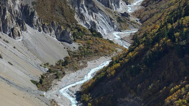
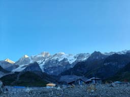
North of Beni the valley narrows into the Kali Gandaki gorge, between Dhaulagiri (8,167 m) to the west and Annapurna I (8,091 m) to the east. It is widely described as the world's deepest gorge, measured by the drop from these flanking peaks to the river. This is the slowest part of the drive: blacktop alternates with gravel, the road is cut into steep slopes, and there are waterfalls, stream crossings and known landslide spots. Tatopani ("hot water") has natural hot spring pools by the river; many travellers stop for a soak on the way back. The road then passes the Rupse waterfall area and climbs to Ghasa, where pine forest begins.

Ghasa to Marpha and Jomsom

Above Ghasa you are in Thakali country. The road passes Lete, Kalopani and Tukuche, with views up to Dhaulagiri and Nilgiri, and the land turns drier as you enter the rain shadow. Marpha, just before Jomsom, is a village of whitewashed stone houses famous for apples. Jomsom, the district headquarters, has the airport, lodges, shops and banks, and is where most people sleep before Muktinath.

Jomsom to Kagbeni and Muktinath

From Jomsom a blacktopped stretch runs up the valley to Kagbeni; improvement work on it began in May 2026, according to the Beni–Jomsom–Korala Road Project (reported by MeroAuto). Near Kagbeni the road turns east and climbs to Ranipauwa, just below the temple. From there it is a gentle walk of about 15 to 25 minutes to Muktinath, and horses are available for anyone who would rather not walk.
Explore Nepal tour packages
View all →

How long does a Mustang road trip take?

A Muktinath road trip from Kathmandu takes at least four days return, and five is more comfortable: one day to Pokhara, one up the gorge to Jomsom, an early morning at Muktinath, then back down. Our Lower Mustang tour runs over five days with a full day for Muktinath, Kagbeni and Dhumba Lake, and the Upper Mustang tour adds a day to reach Lo Manthang. After rain or snow the same drive can take much longer, so keep a spare day if your flight abroad or office leave is tight.

Private 4WD, local jeep or bus: which should you choose?

For families and older travellers, a private 4WD with an experienced local driver is the most comfortable and flexible choice. Local buses and shared jeeps run every day, but usually involve changing vehicles, for example at Beni or Jomsom.

OptionBest forGood pointsThings to know
Private 4WD (Scorpio-class jeep)Families, elders, couples, pilgrims with luggageLeave when you are ready; stop at Tatopani, Marpha or KalikaBook ahead for Dashain and Tihar; choose a driver who knows the Mustang road
Shared or local jeepSmall groups, flexible travellersFrequent on the Beni–Jomsom and Jomsom–Muktinath stretchesWaiting for seats to fill; changes of vehicle
Public busBudget travellers happy with long daysWidely availableSlowest and least comfortable on rough sections; hard on elders

An ordinary car is not suitable beyond Beni; you need a 4WD.

Why is Muktinath sacred to Hindus and Buddhists?

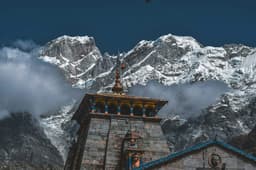
Muktinath is holy to both Hindus and Buddhists. For Hindus it is Mukti Kshetra, a place of liberation and a shrine of Lord Vishnu, counted by Vaishnavas among the 108 Divya Desams. For Tibetan Buddhists it is Chumig Gyatsa, "a hundred waters", associated with Guru Rinpoche (Padmasambhava).

  • The 108 water spouts (Mukti Dhara). Shaped as bull heads, they line the wall around the main temple. Many pilgrims walk under all 108 and bathe in the two small kunda in front of the temple, in water fed by snowmelt.
  • The eternal flame at Jwala Mai. In the small Jwala Mai temple nearby, a flame burns from natural gas escaping the ground beside running water.
  • Shaligram. The black fossil stones Vaishnavas worship as a form of Vishnu come from the Kali Gandaki.

Go early for darshan: mornings are calmer and the wind rises later. The spout water is ice cold at this height, so elders and anyone with heart or blood-pressure problems should keep a bath brief, or sprinkle water instead, and change into dry, warm clothes straight away. Dress modestly, follow the guidance of priests and nuns inside the shrines, and ask before photographing people at prayer.

What else is there to see in Lower Mustang?

Kagbeni

Kagbeni is a medieval village of mud-brick houses, narrow alleys and a red monastery where the Jhong Khola meets the Kali Gandaki. Many Hindu families perform shraddha for their ancestors on the riverbank. It is also the gateway to Upper Mustang: the restricted area begins just north of the village, and documents are checked here.

Marpha

Marpha is Mustang's apple village, known for fresh apples in autumn, dried apple, juice, jam and apple brandy. Its lanes are clean and compact, with firewood stacked on the roofs and a monastery above. It is a good place for a Thakali dal bhat.

Dhumba Lake

Dhumba Lake is a small lake near Thini village, a short drive from Jomsom, with Nilgiri behind it. Buddhists and Hindus treat it as sacred, and by local belief its fish are not caught.

What is the difference between Lower and Upper Mustang?

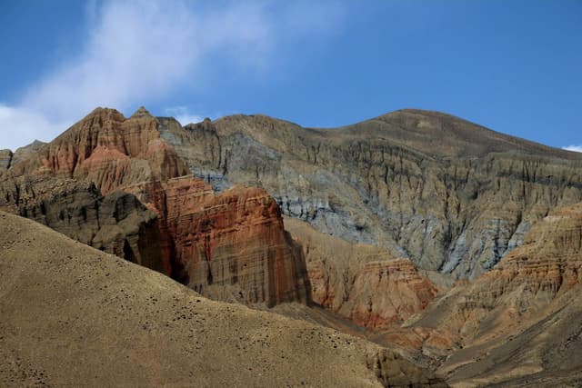
Lower Mustang is the open southern part of the district (Jomsom, Marpha, Kagbeni and Muktinath). Upper Mustang is the restricted area north of Kagbeni, the old Kingdom of Lo, centred on the walled city of Lo Manthang: drier, higher, more remote and almost entirely Tibetan Buddhist in culture.

Lower MustangUpper Mustang
Main placesJomsom, Marpha, Kagbeni, Muktinath, Dhumba LakeLo Manthang, Ghami, Chhoser caves, Korala border area
Highest point on a road tripMuktinath, about 3,700 to 3,800 mKorala, about 4,600 m
RoadMixed blacktop and gravelRough, dusty road beyond Kagbeni
Permits for Nepali citizensNoneNone
Permits for foreign passport holdersAnnapurna Conservation Area permitRestricted-area permit and a licensed guide, plus the conservation area permit
Gomayu tripMustang tour packageUpper Mustang tour

Lo Manthang, the caves and Korala

Lo Manthang was the capital of the Kingdom of Lo and is still enclosed by an earthen wall about six metres high. UNESCO's tentative list describes a 15th-century walled city on an old Kali Gandaki trade route, with the 15th-century Jampa and Thubchen monasteries, the 18th-century Chodey monastery and the palace inside the walls.

Around Lo Manthang are the cliff caves Mustang is known for; at Chhoser, multi-storey caves cut into the cliff can be entered by ladder. North of the city the road climbs to Korala on the Nepal–China border, at about 4,600 m. On our Upper Mustang tour you spend one night in Lo Manthang, visit the Korala border viewpoint, the Chhoser caves and the monasteries, then return to Jomsom. Lo Manthang's Tiji masked-dance festival is usually held in May, with dates set by the Tibetan calendar; lodges fill early around it.

Not sure which Mustang suits your group? Tell our Kathmandu team who is travelling and when, and we will suggest the right one.

How high is Muktinath, and is altitude sickness a risk?

Muktinath sits at about 3,700 to 3,800 m, Jomsom and Kagbeni at about 2,700 to 2,800 m, and Lo Manthang at about 3,800 m. Altitude sickness can start above about 2,500 m, so you are above that line from Marpha onward. Most healthy travellers cope well if they go up gradually.

Take it seriously, especially with elders. In April 2024, The Himalayan Times reported 29 altitude-sickness deaths in Mustang over three years, citing the District Police Office, at places including Muktinath, Jomsom, Marpha and Tukuche; many victims were middle-aged or older. Watch for headache, nausea or vomiting, breathlessness at rest, poor sleep and unusual tiredness.

  • Do not go from Pokhara to Muktinath in one day. Sleep in Jomsom or Marpha first, then visit Muktinath and come back down the same day.
  • Walk slowly, drink plenty of water and skip alcohol the night before. Elders can hire a horse from Ranipauwa.
  • If a headache will not go away, or there is vomiting or confusion, go down. In a jeep, descending is quick.
  • Anyone with heart, lung or blood-pressure conditions, or who is pregnant, should see a doctor before booking, and take altitude medicine only on a doctor's advice.
  • Diaspora families flying in for Dashain should rest a day or two in Kathmandu before setting off.

Do you need a permit for Mustang?

Nepali citizens need no permit for Lower or Upper Mustang. Carry your original citizenship certificate or passport, because documents are checked on the way, including at Kagbeni for Upper Mustang. The area lies inside the Annapurna Conservation Area, which charges an entry fee; on Gomayu tours it is included.

Foreign passport holders, including NRNs travelling on a foreign passport, need the Annapurna Conservation Area permit for Lower Mustang. For Upper Mustang, north of Kagbeni, they also need a restricted-area permit issued through a registered agency, and must travel with a licensed guide. Rules are set by Nepal's Department of Immigration and the conservation area authority and do change, so check close to your dates. If your group mixes Nepali and foreign passports, tell us and we will arrange the right papers for each person.

When is the best time to drive to Mustang?

The best time for a Muktinath road trip is March to May and October to November, when days are mild, skies clear and the road most reliable. Upper Mustang has a longer season and is one of the few Nepal trips that works in the monsoon, because it lies in the rain shadow of the Annapurna and Dhaulagiri ranges.

SeasonLower Mustang and MuktinathUpper Mustang
Spring (March to May)Very good; mild daysVery good; Tiji festival usually in May
Monsoon (June to September)Possible, but landslides are common on the wetter Myagdi sectionGood in the rain shadow, but you still drive through the landslide-prone section
Autumn (October to November)Best; clear skies, apple season, Dashain and Tihar crowdsVery good; clear and cold
Winter (December to February)Cold; snow can block the Kagbeni–Muktinath roadVery cold; some lodges close

Snow is not only a midwinter risk. Mustang's first snowfall of the 2025 season came on 28 October, when the District Administration Office asked people not to travel to Muktinath, and in late January 2026 heavy snow closed the Kagbeni–Muktinath road and pilgrims were stopped at Kagbeni (both reported by Kantipur). For month-by-month weather across the country, see our guide to the best time to visit Nepal.

Dashain and Tihar are the busiest weeks for Mustang. In 2026, Dashain runs from Ghatasthapana on 11 October to Tika on 21 October, and Tihar from 7 to 11 November. Jeeps and lodges in Jomsom and Kagbeni fill early, so book ahead and leave a buffer day.

Is the road to Jomsom and Muktinath safe?

The road is driven safely every day by experienced local drivers in 4WD vehicles, but it is a Himalayan road and weather is the main risk. Landslides and rockfall are most likely in the monsoon and after heavy rain, mainly on the Myagdi stretch between Beni and Ghasa.

On 3 August 2026 a landslide at Baiseri in Raghuganga Rural Municipality stopped traffic on the Beni–Jomsom road, and an excavator clearing it was buried (Kantipur). On 26 September 2026 The Himalayan Times reported heavy rain blocking the Jomsom–Korala road at several points, including the Kagbeni–Tangbe section, and landslides at more than six places on the Beni–Jomsom road, with disruption at Ghasabagar, Tatopani and Rupse.

  • Start early so you are off the gorge road before dark.
  • Use a driver who knows the Mustang road, and let them decide when to wait.
  • Check road news the day before leaving Pokhara in the monsoon or after snowfall.
  • Keep a spare day and travel insurance that covers the trip.

Can you fly from Pokhara to Jomsom instead?

Yes. The Pokhara to Jomsom flight takes about 20 minutes and saves a full day's drive each way. Flights run only in the early morning, because strong winds blow up the Kali Gandaki gorge from around midday, and cloud also grounds flights, so delays and cancellations are common.

Many Nepali families still choose the jeep: it leaves when you are ready, does not depend on the weather window, and shows you the gorge, Tatopani and Marpha. For elders who find long drives hard, flying one way and driving the other, with a spare day, is a good compromise. Our by-road tours do not include flights, but we can arrange them on request.

What should you pack for Mustang by road?

  • Warm layers: a down or fleece jacket, a windproof layer, hat and gloves, even in spring and autumn.
  • Sun and dust: sunglasses, sunscreen, lip balm and a buff or mask for gravel sections.
  • For Muktinath: a towel and a change of clothes if you plan to bathe under the spouts.
  • Health: personal medicines, motion-sickness tablets for the winding gorge road, a small first-aid kit and a water bottle.
  • Documents: original citizenship certificate or passport, plus copies; foreign passport holders also need their permits.
  • Power and cash: a power bank and enough cash for the trip.

What are lodges, money and phone signal like in Mustang?

Mustang has family-run local lodges, not luxury hotels. The best in Jomsom, Marpha and Kagbeni have clean private rooms, warm blankets, solar-heated showers and a stove-warmed dining room serving Thakali food, but bedrooms are generally unheated and electricity can be intermittent; Upper Mustang lodges are simpler. Carry enough cash from Pokhara, because ATMs in Jomsom are not reliable, and do not count on mobile data everywhere in the gorge or in Upper Mustang.

Is Manang a good alternative to Mustang?

Manang is Mustang's neighbour on the other side of the Annapurnas and can also be reached by 4WD, up the Marsyangdi valley from Besisahar through Chame and Pisang to Manang village at about 3,540 m, near Gangapurna Lake. Our Manang tour goes via Bandipur, Chame and Upper Pisang and returns via Besisahar. There is no road between the two valleys, only the Thorong La footpass at about 5,400 m, so most people do them as separate trips.

Planning your Mustang trip with Gomayu

Gomayu runs a Lower Mustang tour to Jomsom, Kagbeni and Muktinath and an Upper Mustang tour to Lo Manthang, both by private 4WD from Kathmandu. Hotels, transfers and sightseeing are planned by our Kathmandu team, every package shows a price for each group size on its page, and tours can be adjusted on request. Browse our Nepal tour packages, or send your dates and group size on WhatsApp for a quote.

Frequently asked questions

Can you go from Kathmandu to Muktinath by road?

Yes. You can drive from Kathmandu to Muktinath via Pokhara, Beni, Tatopani, Ghasa, Marpha, Jomsom and Kagbeni to Ranipauwa, a short walk below the temple. A 4WD is needed beyond Beni. Most people take two days each way, sleeping in Pokhara and then Jomsom or Marpha before Muktinath, which also helps with the altitude.

How long does it take to reach Muktinath by jeep?

Reaching Muktinath by jeep from Kathmandu usually takes two days: about 6 to 7 hours to Pokhara, then a full day up the Kali Gandaki gorge to Jomsom. Muktinath is a short early-morning drive from Jomsom. Monsoon landslides or winter snow can add hours or days, so keep a spare day.

Do Nepali citizens need a permit for Mustang or Upper Mustang?

No. Nepali citizens need no permit for Lower or Upper Mustang, including Lo Manthang. Carry your original citizenship certificate or passport, as documents are checked on the way, including at Kagbeni. The Annapurna Conservation Area charges an entry fee, which is included in Gomayu's Mustang tours.

What permits do foreigners and NRNs on foreign passports need for Mustang?

Foreign passport holders, including NRNs on a foreign passport, need the Annapurna Conservation Area permit for Lower Mustang. For Upper Mustang, north of Kagbeni, they also need a restricted-area permit issued through a registered agency and must travel with a licensed guide. Rules change, so check close to your dates.

How high is Muktinath, and is altitude sickness a risk?

Muktinath temple is at about 3,700 to 3,800 m, above the 2,500 m level where altitude sickness can start. Most healthy travellers cope if they sleep in Jomsom or Marpha first, walk slowly, drink water and avoid alcohol. Anyone with heart, lung or blood-pressure problems should see a doctor before going to Muktinath.

What is the best time to visit Muktinath by road?

The best time to visit Muktinath by road is March to May and October to November, when the weather is mild and the road most reliable. Monsoon landslides often affect the Beni to Ghasa section, and winter snow can close the Kagbeni–Muktinath road, as in late January 2026. Book early for Dashain and Tihar.

Should we fly to Jomsom or go by jeep?

Fly to Jomsom if you are short of time and can accept that the early-morning flights are often delayed or cancelled by wind and cloud. Go by jeep for a fixed plan, plenty of luggage and the whole Kali Gandaki gorge, Tatopani and Marpha on the way. Many families fly one way and drive the other.

Is a Muktinath trip suitable for elderly parents?

Yes, a Muktinath road trip suits elderly parents in reasonable health, because the jeep does the climbing and horses are available from Ranipauwa to the temple. Plan for long, bumpy days, cold mornings and the altitude. Get a doctor's advice first, keep the bath under the 108 spouts short, and sleep in Jomsom or Marpha before the visit.

Can you drive from Mustang to Manang?

No. There is no road between Mustang and Manang; the two valleys are linked only on foot over the Thorong La pass, at about 5,400 m. By road, Manang is reached from Besisahar up the Marsyangdi valley, so Mustang and Manang are usually separate road trips, each with its own acclimatisation stops.

Muktinath kasari jane?

Muktinath jana Kathmandu bata Pokhara samma gadi ma, ani Pokhara bata Beni, Tatopani, Ghasa ra Marpha hudai Jomsom samma jeep ma janu parcha. Jomsom bata Kagbeni hudai Ranipauwa samma jeep jancha, tyaha bata mandir samma 15 dekhi 25 minet hidne. Pokhara bata Jomsom plane pani udcha, tara bihana matra, ra hawa chalda flight radda huna sakcha.

Tags
NepalMustangMuktinathJomsomUpper MustangRoad Trip
Share
G
Gomayu Team
Writer at Gomayu
Keep reading
Blog / Nepal
Mustang by Road: Jomsom, Muktinath and Lo Manthang
17 min read 09 Oct 2026
Jeep road through the Kali Gandaki valley in Mustang, Nepal, on the way to Jomsom and Muktinath

Short answer: you can drive all the way from Kathmandu to Muktinath. The road runs to Pokhara, then Beni, Tatopani and Ghasa up the Kali Gandaki gorge to Marpha and Jomsom, and on through Kagbeni to Ranipauwa, a short walk below the temple. Most people take two days each way, with a night in Pokhara. Nepali citizens need no permit; foreign passport holders do.

This guide is for families taking parents for Muktinath darshan, couples who want the high desert without a trek, Nepalis coming home from abroad for Dashain, and anyone weighing a jeep against the Jomsom flight. Road news in it is dated, because conditions on this route change week to week. If you would rather hand over the planning, our Mustang tour package covers Jomsom, Kagbeni and Muktinath by private 4WD, and our Kathmandu team can send a quote on WhatsApp.

Mustang by road at a glance

StageTypical timeHeight (approx.)What to expect
Kathmandu to PokharaAbout 6 to 7 hoursPokhara about 800 mPrithvi Highway, about 200 km; busy at festival time
Pokhara to JomsomA full dayJomsom about 2,700 mVia Kusma, Baglung, Beni, Tatopani, Ghasa and Marpha; mixed blacktop, gravel and rough sections
Jomsom to Kagbeni and MuktinathA short morning driveKagbeni about 2,800 m; Muktinath about 3,700 to 3,800 mBlacktop to Kagbeni, then a climb to Ranipauwa
Kagbeni to Lo ManthangA long dayLo Manthang about 3,800 mRough, dusty road through restricted Upper Mustang

Heights are rounded; published figures differ slightly between sources.

How do you get from Kathmandu to Muktinath by road?

The road to Muktinath follows the Kali Gandaki river north from Beni through Myagdi into Mustang district. It is part of the Beni–Jomsom–Korala road, which continues to the Nepal–China border at Korala. Here is the route in the order you drive it.

Kathmandu to Pokhara

The first leg is the Prithvi Highway, about 200 km and usually 6 to 7 hours with a lunch stop. Almost everyone breaks the journey in Pokhara: going straight through to Jomsom means 14 hours or more on the road and arriving after dark. If you want more time by the lake, our Pokhara tour package can be added before or after Mustang.

Pokhara to Beni via Kusma and Baglung

From Pokhara the paved road crosses the hills to Kusma, then follows the Kali Gandaki to Baglung and Beni, the headquarters of Myagdi district. Baglung is home to the Baglung Kalika temple, a common pilgrim stop, especially on the way back. Beni is the last big bazaar; the mountain road starts here.

Beni to Tatopani and Ghasa: into the gorge

North of Beni the valley narrows into the Kali Gandaki gorge, between Dhaulagiri (8,167 m) to the west and Annapurna I (8,091 m) to the east. It is widely described as the world's deepest gorge, measured by the drop from these flanking peaks to the river. This is the slowest part of the drive: blacktop alternates with gravel, the road is cut into steep slopes, and there are waterfalls, stream crossings and known landslide spots. Tatopani ("hot water") has natural hot spring pools by the river; many travellers stop for a soak on the way back. The road then passes the Rupse waterfall area and climbs to Ghasa, where pine forest begins.

Ghasa to Marpha and Jomsom

Above Ghasa you are in Thakali country. The road passes Lete, Kalopani and Tukuche, with views up to Dhaulagiri and Nilgiri, and the land turns drier as you enter the rain shadow. Marpha, just before Jomsom, is a village of whitewashed stone houses famous for apples. Jomsom, the district headquarters, has the airport, lodges, shops and banks, and is where most people sleep before Muktinath.

Jomsom to Kagbeni and Muktinath

From Jomsom a blacktopped stretch runs up the valley to Kagbeni; improvement work on it began in May 2026, according to the Beni–Jomsom–Korala Road Project (reported by MeroAuto). Near Kagbeni the road turns east and climbs to Ranipauwa, just below the temple. From there it is a gentle walk of about 15 to 25 minutes to Muktinath, and horses are available for anyone who would rather not walk.
Explore Nepal tour packages
View all →

How long does a Mustang road trip take?

A Muktinath road trip from Kathmandu takes at least four days return, and five is more comfortable: one day to Pokhara, one up the gorge to Jomsom, an early morning at Muktinath, then back down. Our Lower Mustang tour runs over five days with a full day for Muktinath, Kagbeni and Dhumba Lake, and the Upper Mustang tour adds a day to reach Lo Manthang. After rain or snow the same drive can take much longer, so keep a spare day if your flight abroad or office leave is tight.

Private 4WD, local jeep or bus: which should you choose?

For families and older travellers, a private 4WD with an experienced local driver is the most comfortable and flexible choice. Local buses and shared jeeps run every day, but usually involve changing vehicles, for example at Beni or Jomsom.

OptionBest forGood pointsThings to know
Private 4WD (Scorpio-class jeep)Families, elders, couples, pilgrims with luggageLeave when you are ready; stop at Tatopani, Marpha or KalikaBook ahead for Dashain and Tihar; choose a driver who knows the Mustang road
Shared or local jeepSmall groups, flexible travellersFrequent on the Beni–Jomsom and Jomsom–Muktinath stretchesWaiting for seats to fill; changes of vehicle
Public busBudget travellers happy with long daysWidely availableSlowest and least comfortable on rough sections; hard on elders

An ordinary car is not suitable beyond Beni; you need a 4WD.

Why is Muktinath sacred to Hindus and Buddhists?

Muktinath is holy to both Hindus and Buddhists. For Hindus it is Mukti Kshetra, a place of liberation and a shrine of Lord Vishnu, counted by Vaishnavas among the 108 Divya Desams. For Tibetan Buddhists it is Chumig Gyatsa, "a hundred waters", associated with Guru Rinpoche (Padmasambhava).

  • The 108 water spouts (Mukti Dhara). Shaped as bull heads, they line the wall around the main temple. Many pilgrims walk under all 108 and bathe in the two small kunda in front of the temple, in water fed by snowmelt.
  • The eternal flame at Jwala Mai. In the small Jwala Mai temple nearby, a flame burns from natural gas escaping the ground beside running water.
  • Shaligram. The black fossil stones Vaishnavas worship as a form of Vishnu come from the Kali Gandaki.

Go early for darshan: mornings are calmer and the wind rises later. The spout water is ice cold at this height, so elders and anyone with heart or blood-pressure problems should keep a bath brief, or sprinkle water instead, and change into dry, warm clothes straight away. Dress modestly, follow the guidance of priests and nuns inside the shrines, and ask before photographing people at prayer.

What else is there to see in Lower Mustang?

Kagbeni

Kagbeni is a medieval village of mud-brick houses, narrow alleys and a red monastery where the Jhong Khola meets the Kali Gandaki. Many Hindu families perform shraddha for their ancestors on the riverbank. It is also the gateway to Upper Mustang: the restricted area begins just north of the village, and documents are checked here.

Marpha

Marpha is Mustang's apple village, known for fresh apples in autumn, dried apple, juice, jam and apple brandy. Its lanes are clean and compact, with firewood stacked on the roofs and a monastery above. It is a good place for a Thakali dal bhat.

Dhumba Lake

Dhumba Lake is a small lake near Thini village, a short drive from Jomsom, with Nilgiri behind it. Buddhists and Hindus treat it as sacred, and by local belief its fish are not caught.

What is the difference between Lower and Upper Mustang?

Lower Mustang is the open southern part of the district (Jomsom, Marpha, Kagbeni and Muktinath). Upper Mustang is the restricted area north of Kagbeni, the old Kingdom of Lo, centred on the walled city of Lo Manthang: drier, higher, more remote and almost entirely Tibetan Buddhist in culture.

Lower MustangUpper Mustang
Main placesJomsom, Marpha, Kagbeni, Muktinath, Dhumba LakeLo Manthang, Ghami, Chhoser caves, Korala border area
Highest point on a road tripMuktinath, about 3,700 to 3,800 mKorala, about 4,600 m
RoadMixed blacktop and gravelRough, dusty road beyond Kagbeni
Permits for Nepali citizensNoneNone
Permits for foreign passport holdersAnnapurna Conservation Area permitRestricted-area permit and a licensed guide, plus the conservation area permit
Gomayu tripMustang tour packageUpper Mustang tour

Lo Manthang, the caves and Korala

Lo Manthang was the capital of the Kingdom of Lo and is still enclosed by an earthen wall about six metres high. UNESCO's tentative list describes a 15th-century walled city on an old Kali Gandaki trade route, with the 15th-century Jampa and Thubchen monasteries, the 18th-century Chodey monastery and the palace inside the walls.

Around Lo Manthang are the cliff caves Mustang is known for; at Chhoser, multi-storey caves cut into the cliff can be entered by ladder. North of the city the road climbs to Korala on the Nepal–China border, at about 4,600 m. On our Upper Mustang tour you spend one night in Lo Manthang, visit the Korala border viewpoint, the Chhoser caves and the monasteries, then return to Jomsom. Lo Manthang's Tiji masked-dance festival is usually held in May, with dates set by the Tibetan calendar; lodges fill early around it.

Not sure which Mustang suits your group? Tell our Kathmandu team who is travelling and when, and we will suggest the right one.

How high is Muktinath, and is altitude sickness a risk?

Muktinath sits at about 3,700 to 3,800 m, Jomsom and Kagbeni at about 2,700 to 2,800 m, and Lo Manthang at about 3,800 m. Altitude sickness can start above about 2,500 m, so you are above that line from Marpha onward. Most healthy travellers cope well if they go up gradually.

Take it seriously, especially with elders. In April 2024, The Himalayan Times reported 29 altitude-sickness deaths in Mustang over three years, citing the District Police Office, at places including Muktinath, Jomsom, Marpha and Tukuche; many victims were middle-aged or older. Watch for headache, nausea or vomiting, breathlessness at rest, poor sleep and unusual tiredness.

  • Do not go from Pokhara to Muktinath in one day. Sleep in Jomsom or Marpha first, then visit Muktinath and come back down the same day.
  • Walk slowly, drink plenty of water and skip alcohol the night before. Elders can hire a horse from Ranipauwa.
  • If a headache will not go away, or there is vomiting or confusion, go down. In a jeep, descending is quick.
  • Anyone with heart, lung or blood-pressure conditions, or who is pregnant, should see a doctor before booking, and take altitude medicine only on a doctor's advice.
  • Diaspora families flying in for Dashain should rest a day or two in Kathmandu before setting off.

Do you need a permit for Mustang?

Nepali citizens need no permit for Lower or Upper Mustang. Carry your original citizenship certificate or passport, because documents are checked on the way, including at Kagbeni for Upper Mustang. The area lies inside the Annapurna Conservation Area, which charges an entry fee; on Gomayu tours it is included.

Foreign passport holders, including NRNs travelling on a foreign passport, need the Annapurna Conservation Area permit for Lower Mustang. For Upper Mustang, north of Kagbeni, they also need a restricted-area permit issued through a registered agency, and must travel with a licensed guide. Rules are set by Nepal's Department of Immigration and the conservation area authority and do change, so check close to your dates. If your group mixes Nepali and foreign passports, tell us and we will arrange the right papers for each person.

When is the best time to drive to Mustang?

The best time for a Muktinath road trip is March to May and October to November, when days are mild, skies clear and the road most reliable. Upper Mustang has a longer season and is one of the few Nepal trips that works in the monsoon, because it lies in the rain shadow of the Annapurna and Dhaulagiri ranges.

SeasonLower Mustang and MuktinathUpper Mustang
Spring (March to May)Very good; mild daysVery good; Tiji festival usually in May
Monsoon (June to September)Possible, but landslides are common on the wetter Myagdi sectionGood in the rain shadow, but you still drive through the landslide-prone section
Autumn (October to November)Best; clear skies, apple season, Dashain and Tihar crowdsVery good; clear and cold
Winter (December to February)Cold; snow can block the Kagbeni–Muktinath roadVery cold; some lodges close

Snow is not only a midwinter risk. Mustang's first snowfall of the 2025 season came on 28 October, when the District Administration Office asked people not to travel to Muktinath, and in late January 2026 heavy snow closed the Kagbeni–Muktinath road and pilgrims were stopped at Kagbeni (both reported by Kantipur). For month-by-month weather across the country, see our guide to the best time to visit Nepal.

Dashain and Tihar are the busiest weeks for Mustang. In 2026, Dashain runs from Ghatasthapana on 11 October to Tika on 21 October, and Tihar from 7 to 11 November. Jeeps and lodges in Jomsom and Kagbeni fill early, so book ahead and leave a buffer day.

Is the road to Jomsom and Muktinath safe?

The road is driven safely every day by experienced local drivers in 4WD vehicles, but it is a Himalayan road and weather is the main risk. Landslides and rockfall are most likely in the monsoon and after heavy rain, mainly on the Myagdi stretch between Beni and Ghasa.

On 3 August 2026 a landslide at Baiseri in Raghuganga Rural Municipality stopped traffic on the Beni–Jomsom road, and an excavator clearing it was buried (Kantipur). On 26 September 2026 The Himalayan Times reported heavy rain blocking the Jomsom–Korala road at several points, including the Kagbeni–Tangbe section, and landslides at more than six places on the Beni–Jomsom road, with disruption at Ghasabagar, Tatopani and Rupse.

  • Start early so you are off the gorge road before dark.
  • Use a driver who knows the Mustang road, and let them decide when to wait.
  • Check road news the day before leaving Pokhara in the monsoon or after snowfall.
  • Keep a spare day and travel insurance that covers the trip.

Can you fly from Pokhara to Jomsom instead?

Yes. The Pokhara to Jomsom flight takes about 20 minutes and saves a full day's drive each way. Flights run only in the early morning, because strong winds blow up the Kali Gandaki gorge from around midday, and cloud also grounds flights, so delays and cancellations are common.

Many Nepali families still choose the jeep: it leaves when you are ready, does not depend on the weather window, and shows you the gorge, Tatopani and Marpha. For elders who find long drives hard, flying one way and driving the other, with a spare day, is a good compromise. Our by-road tours do not include flights, but we can arrange them on request.

What should you pack for Mustang by road?

  • Warm layers: a down or fleece jacket, a windproof layer, hat and gloves, even in spring and autumn.
  • Sun and dust: sunglasses, sunscreen, lip balm and a buff or mask for gravel sections.
  • For Muktinath: a towel and a change of clothes if you plan to bathe under the spouts.
  • Health: personal medicines, motion-sickness tablets for the winding gorge road, a small first-aid kit and a water bottle.
  • Documents: original citizenship certificate or passport, plus copies; foreign passport holders also need their permits.
  • Power and cash: a power bank and enough cash for the trip.

What are lodges, money and phone signal like in Mustang?

Mustang has family-run local lodges, not luxury hotels. The best in Jomsom, Marpha and Kagbeni have clean private rooms, warm blankets, solar-heated showers and a stove-warmed dining room serving Thakali food, but bedrooms are generally unheated and electricity can be intermittent; Upper Mustang lodges are simpler. Carry enough cash from Pokhara, because ATMs in Jomsom are not reliable, and do not count on mobile data everywhere in the gorge or in Upper Mustang.

Is Manang a good alternative to Mustang?

Manang is Mustang's neighbour on the other side of the Annapurnas and can also be reached by 4WD, up the Marsyangdi valley from Besisahar through Chame and Pisang to Manang village at about 3,540 m, near Gangapurna Lake. Our Manang tour goes via Bandipur, Chame and Upper Pisang and returns via Besisahar. There is no road between the two valleys, only the Thorong La footpass at about 5,400 m, so most people do them as separate trips.

Planning your Mustang trip with Gomayu

Gomayu runs a Lower Mustang tour to Jomsom, Kagbeni and Muktinath and an Upper Mustang tour to Lo Manthang, both by private 4WD from Kathmandu. Hotels, transfers and sightseeing are planned by our Kathmandu team, every package shows a price for each group size on its page, and tours can be adjusted on request. Browse our Nepal tour packages, or send your dates and group size on WhatsApp for a quote.

Frequently asked questions

Can you go from Kathmandu to Muktinath by road?

Yes. You can drive from Kathmandu to Muktinath via Pokhara, Beni, Tatopani, Ghasa, Marpha, Jomsom and Kagbeni to Ranipauwa, a short walk below the temple. A 4WD is needed beyond Beni. Most people take two days each way, sleeping in Pokhara and then Jomsom or Marpha before Muktinath, which also helps with the altitude.

How long does it take to reach Muktinath by jeep?

Reaching Muktinath by jeep from Kathmandu usually takes two days: about 6 to 7 hours to Pokhara, then a full day up the Kali Gandaki gorge to Jomsom. Muktinath is a short early-morning drive from Jomsom. Monsoon landslides or winter snow can add hours or days, so keep a spare day.

Do Nepali citizens need a permit for Mustang or Upper Mustang?

No. Nepali citizens need no permit for Lower or Upper Mustang, including Lo Manthang. Carry your original citizenship certificate or passport, as documents are checked on the way, including at Kagbeni. The Annapurna Conservation Area charges an entry fee, which is included in Gomayu's Mustang tours.

What permits do foreigners and NRNs on foreign passports need for Mustang?

Foreign passport holders, including NRNs on a foreign passport, need the Annapurna Conservation Area permit for Lower Mustang. For Upper Mustang, north of Kagbeni, they also need a restricted-area permit issued through a registered agency and must travel with a licensed guide. Rules change, so check close to your dates.

How high is Muktinath, and is altitude sickness a risk?

Muktinath temple is at about 3,700 to 3,800 m, above the 2,500 m level where altitude sickness can start. Most healthy travellers cope if they sleep in Jomsom or Marpha first, walk slowly, drink water and avoid alcohol. Anyone with heart, lung or blood-pressure problems should see a doctor before going to Muktinath.

What is the best time to visit Muktinath by road?

The best time to visit Muktinath by road is March to May and October to November, when the weather is mild and the road most reliable. Monsoon landslides often affect the Beni to Ghasa section, and winter snow can close the Kagbeni–Muktinath road, as in late January 2026. Book early for Dashain and Tihar.

Should we fly to Jomsom or go by jeep?

Fly to Jomsom if you are short of time and can accept that the early-morning flights are often delayed or cancelled by wind and cloud. Go by jeep for a fixed plan, plenty of luggage and the whole Kali Gandaki gorge, Tatopani and Marpha on the way. Many families fly one way and drive the other.

Is a Muktinath trip suitable for elderly parents?

Yes, a Muktinath road trip suits elderly parents in reasonable health, because the jeep does the climbing and horses are available from Ranipauwa to the temple. Plan for long, bumpy days, cold mornings and the altitude. Get a doctor's advice first, keep the bath under the 108 spouts short, and sleep in Jomsom or Marpha before the visit.

Can you drive from Mustang to Manang?

No. There is no road between Mustang and Manang; the two valleys are linked only on foot over the Thorong La pass, at about 5,400 m. By road, Manang is reached from Besisahar up the Marsyangdi valley, so Mustang and Manang are usually separate road trips, each with its own acclimatisation stops.

Muktinath kasari jane?

Muktinath jana Kathmandu bata Pokhara samma gadi ma, ani Pokhara bata Beni, Tatopani, Ghasa ra Marpha hudai Jomsom samma jeep ma janu parcha. Jomsom bata Kagbeni hudai Ranipauwa samma jeep jancha, tyaha bata mandir samma 15 dekhi 25 minet hidne. Pokhara bata Jomsom plane pani udcha, tara bihana matra, ra hawa chalda flight radda huna sakcha.
Tags
NepalMustangMuktinathJomsomUpper MustangRoad Trip
Share
G
Gomayu Team
Writer at Gomayu
Keep reading