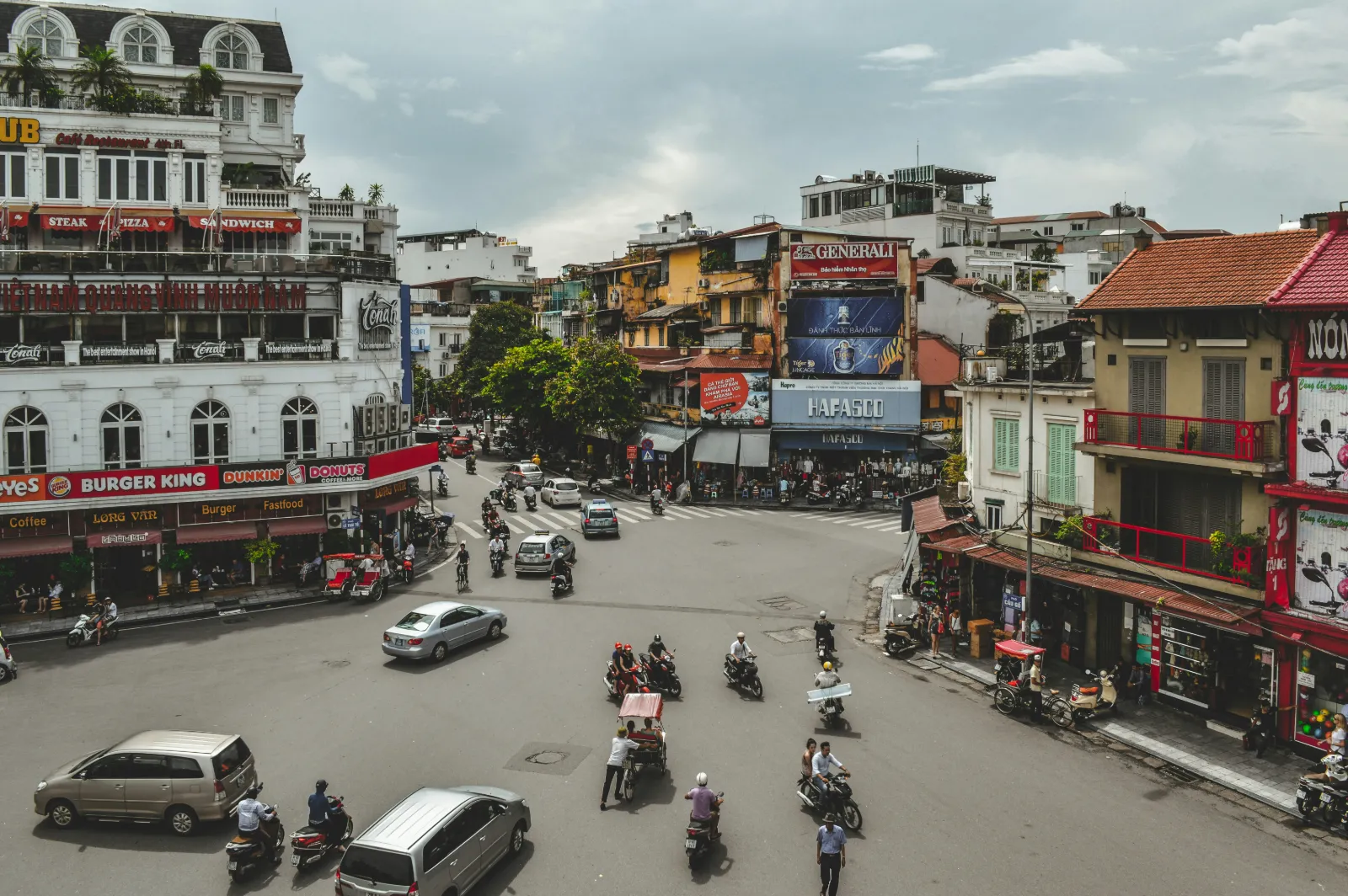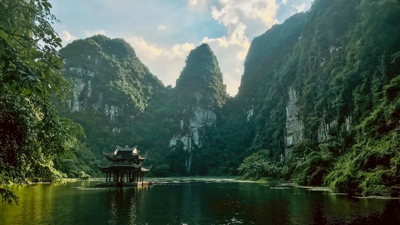



























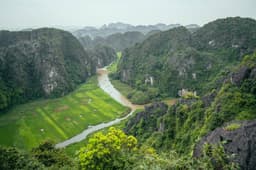

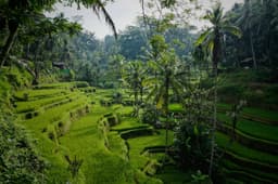









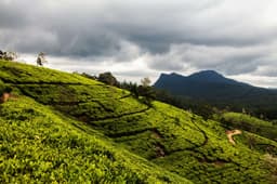













Short answer: Sapa is a mountain town in the far north of Vietnam, close to the Chinese border, known for terraced rice valleys, village walks and Fansipan, the highest peak in Indochina. Plan a Sapa Vietnam trip for late April to May for water-filled terraces, July and August for green rice, or September for gold before the harvest. Sapa trekking is mostly gentle valley walking a little above the height of Kathmandu, so it suits most reasonably fit travellers. Expect real crowds in town and on the easiest trails, and a cable car that takes you almost to the summit of Fansipan in under half an hour.
This guide covers where Sapa is and how it changed in 2025, a month by month rice terrace calendar, the main treks with honest difficulty notes, the rules on guides and park permits, Fansipan by cable car or on foot, the train and bus options from Hanoi, and what to pack. Every volatile fact carries the source we checked it against. If you are coming from Nepal, there are notes throughout on how Sapa compares with walking in our own hills.
Where is Sapa Vietnam and why do people visit?
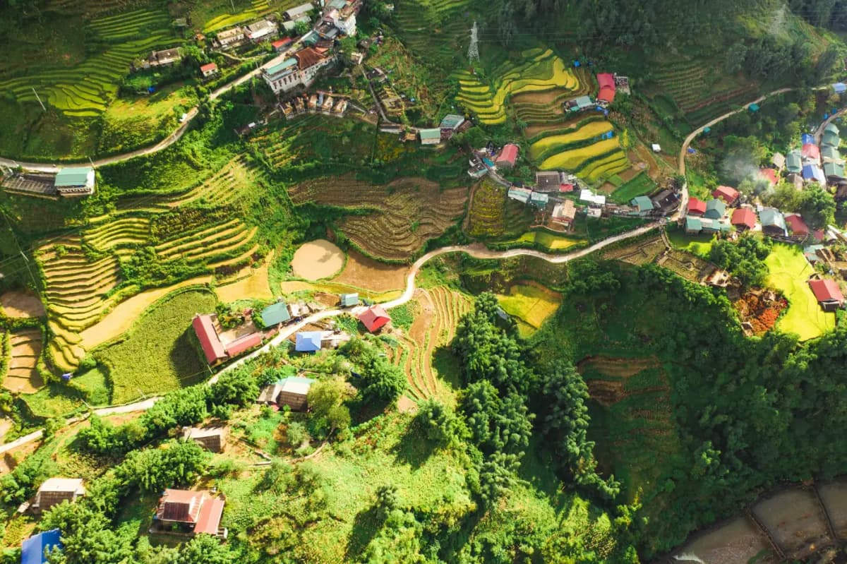
Sapa sits in the Hoang Lien Son mountains of northwest Vietnam, about 300 km northwest of Hanoi, with the town at roughly 1,600 metres above sea level, according to Bao Lao Cai. People come for three things: the terraced rice valleys that fall away below the town, walks between villages of the Hmong, Red Dao, Giay and Tay communities, and Fansipan, the 3,147 metre summit that towers over the valley.
The town itself started as a French hill station in the colonial period, and its stone church was begun in 1925 and finished in 1935, as Bao Lao Cai records. Today the centre is a busy resort of hotels, cafes and a lake, while the real draw lies outside it, in the Muong Hoa valley below the town and the side valleys towards Ta Phin and Ban Ho. If you are still deciding whether the north fits your trip, our list of the best places to visit in Vietnam puts Sapa alongside Ha Long Bay, Ninh Binh and Hanoi.
Sapa after the 2025 provincial merger
Vietnam reorganised its provinces and communes in 2025, and Sapa's official status changed. You will see new names on maps, tickets and hotel addresses, so it helps to know what happened.
- New Lao Cai province: National Assembly Resolution 202/2025/QH15, adopted on 12 June 2025, merged the whole of Yen Bai and Lao Cai provinces into a single province that keeps the name Lao Cai. The new provincial government began work on 1 July 2025. This means Mu Cang Chai, famous for its own terraces and formerly in Yen Bai, is now also in Lao Cai province.
- Sa Pa is now a ward: Under Resolution 1673/NQ-UBTVQH15 of 16 June 2025, six wards of the old town, including Sa Pa, Ham Rong, O Quy Ho and Phan Si Pang, were merged into a single Sa Pa ward. The former Sa Pa town no longer exists as a separate administrative unit.
- The trekking valleys are now communes: The same resolution merged Hoang Lien, Muong Hoa and Ta Van into a new Ta Van commune, joined Trung Chai and Ta Phin into Ta Phin commune, and merged Thanh Binh and Ban Ho into Ban Ho commune.
Nothing changed on the ground for visitors. Locals and travel companies still say "Sapa" for the whole area, and so does this guide. Checked: 5 Nov 2026.
Sapa at a glance
| Item | Detail |
|---|---|
| Location | Sa Pa ward, Lao Cai province, northwest Vietnam, near the Chinese border |
| Height of town | About 1,600 m |
| Highest nearby peak | Fansipan, 3,147.3 m (2019 survey) |
| Main communities | Hmong, Red Dao, Tay, Giay and Xa Pho, plus Kinh (ethnic Vietnamese) |
| Nearest railway station | Lao Cai, about 35 km away by road |
| Best months for terraces | Late April to May (water), July to August (green), September (gold) |
| Coolest months | December to February, with occasional frost |
| Visitors in 2025 | 4.45 million visits, of which about 630,000 international |
For the bigger picture of travelling in the country, including money, transport and visas, start with our Vietnam travel guide.
When is the best time to see the rice terraces?
The best time to see Sapa's rice terraces depends on which look you want: shining water from late April to mid May, bright green rice in July and August, or ripe golden rice through September before the harvest. The terraces around Sapa are usually planted only once a year, so each stage comes round only once, and the exact timing shifts by a week or two with altitude and the year's rain.
Local reporting from the provincial newspaper Bao Lao Cai gives the clearest calendar. Its piece on the water pouring season recommends late April to mid May, when the first heavy rains fill the terraces and farmers plough and transplant wherever water arrives. Its report on the young green rice season places it in July and August, with farmers expecting the green to turn gold two to three months later. Vietnam's national tourism site says the best time to see Sapa is just before harvest, when skies tend to be clear from mid August to early September.
Sapa rice terrace calendar by month
| Month | What the terraces look like | Weather and walking |
|---|---|---|
| January to February | Between crops: bare, brown or partly dry terraces | Coldest months, fog common, rare frost or snow |
| March | Still between crops, ploughing starts on some fields | Warming, generally dry, good walking |
| Late April to mid May | Water pouring season: flooded terraces reflect the sky, ploughing and transplanting | Rains begin, mornings often clear, popular with photographers |
| June | Young rice settling in, valleys turning from silver to green | Rain increasing, trails can be muddy |
| July to August | Green season: thick, bright green rice | Heart of the rainy season, slippery paths, cloud on Fansipan |
| September | Rice ripening to gold across the Muong Hoa, Lao Chai and Ta Van valleys | Rain easing, the busiest month for terrace photography |
| Late September to early October | Harvest: some fields gold, others cut | Cooler, clearer, very pleasant walking |
| October to December | Harvested stubble, terraces bare | Dry, crisp, clear views; cold nights from November |
Remember that rice is a farm crop, not a show. A cold spring or a late monsoon can push everything back, and the lowest fields near streams ripen before the highest ones. If golden terraces are the single reason for your trip, aim for the first three weeks of September and keep a day or two of slack. For how Sapa fits into the wider weather picture across Vietnam's three climate zones, see our guide to the best time to visit Vietnam.
Sapa or Mu Cang Chai for golden terraces?
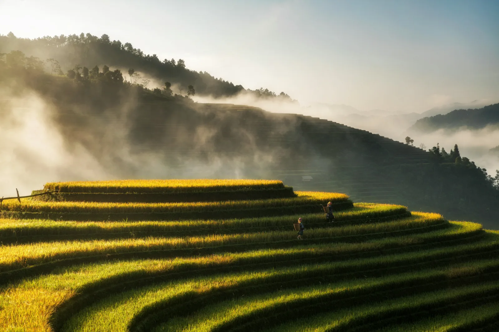
Mu Cang Chai has the more dramatic golden terraces, while Sapa has better walking, more places to stay and easier transport. Vietnam's national tourism site describes Mu Cang Chai's terraces as built by the Hmong and covering more than 2,000 hectares, with September and October as the time when the stalks are golden and heavy.
| Question | Sapa | Mu Cang Chai |
|---|---|---|
| Golden season | Mainly September, harvest into early October | September and October |
| Best for | Multi day village treks, homestays, Fansipan | Viewpoints and photography of huge terrace bowls |
| Getting there from Hanoi | Expressway bus or overnight train to Lao Cai | A long road journey, usually by private car or tour |
| Accommodation | Wide range, from homestays to large hotels | Mostly homestays and small guesthouses |
| Crowds | Heavy in town and on the easiest trails | Busy at the main viewpoints during harvest weekends |
Since the 2025 merger both places sit in the same Lao Cai province, but they are still far apart by road. Treat Mu Cang Chai as its own side trip rather than a quick add-on from Sapa.
Dashain, Tihar and the terraces: what you will actually see
For travellers from Nepal, the honest point is timing. Dashain usually falls between late September and October and Tihar follows in October or November, which is exactly when most of Sapa's rice has been cut. A Dashain trip will usually catch the end of the harvest at best, and a Tihar trip will see bare, harvested terraces.
That does not make autumn a bad choice. October and November bring some of the clearest, driest walking weather of the year, the trails are firm, and Fansipan is more likely to be above the cloud. You trade colour for comfort. If golden rice matters more than the festival break, travel in early to mid September. If you can only travel around Dashain, consider Mu Cang Chai in early October for the last of the gold, and Sapa for walking.
When is Sapa most crowded?
Sapa is busiest during Vietnamese public holidays and summer school breaks, not just in the classic foreign high season. The town received 4.45 million visits in 2025, according to figures presented at a provincial tourism conference in January 2026, and delegates there spoke openly about growing pressure on the core of the town. Local officials estimated more than 140,000 visits over the Tet holiday alone, from 25 January to 3 February 2025, according to Nhan Dan.
- Busiest: Tet (Lunar New Year, January or February), the 30 April and 1 May holiday, National Day on 2 September, summer school holidays, and weekends in September.
- Quieter: weekdays in March, late October, November and early December.
- Tip: stay in a valley village rather than the town centre, start walks early, and avoid arriving in Sapa on a Friday evening in harvest season.





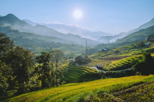
What are the best treks around Sapa?
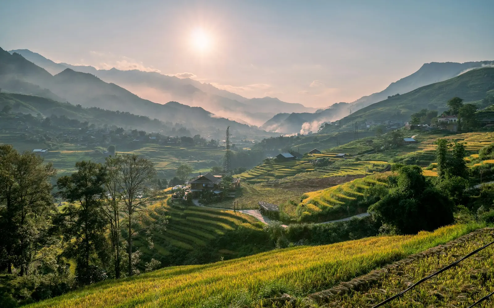
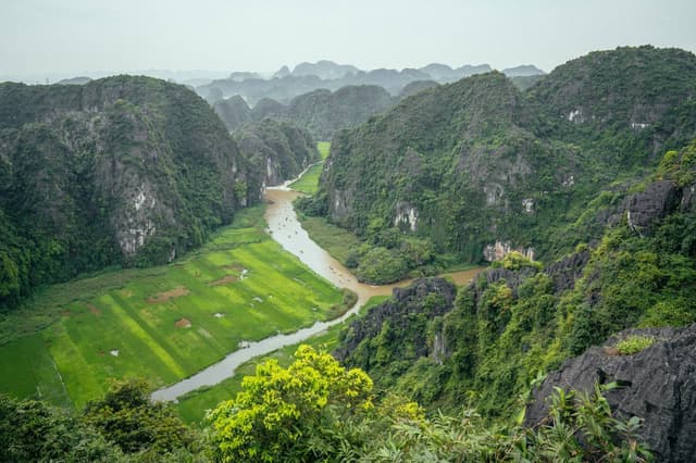
The best treks around Sapa are the Muong Hoa valley walk through Lao Chai and Ta Van, the steeper Y Linh Ho descent, the side valley to Ta Phin, and longer two or three day routes towards Ban Ho with homestay nights. Fansipan is a separate, much harder mountain climb. Most valley treks follow farm paths, concrete village lanes and short stretches of road, so Sapa trekking is about rice, villages and views rather than high passes.
Distances below come from Bao Lao Cai's village guide where given. Walking times depend heavily on mud, route choice and how often you stop, so we describe them in half days and days rather than hours.
| Route | What you see | Difficulty | Time |
|---|---|---|---|
| Cat Cat village and waterfall | A Hmong village about 2 km below town, craft demonstrations, waterfall | Easy, but steep steps back up | Half day |
| Lao Chai to Ta Van, Muong Hoa valley | The classic terrace valley, Hmong and Giay villages, river crossings | Easy to moderate | Full day (Ta Van is about 10 km by mountain trail) |
| Y Linh Ho, Lao Chai, Ta Van | Higher views over the valley, then a long descent through terraces | Moderate, slippery when wet | Full day |
| Ta Phin | Hmong and Red Dao communities, Red Dao herbal baths | Easy to moderate | Half to full day (about 12 km from town) |
| Sin Chai | Quieter village reached on foot from Cat Cat | Moderate | Half to full day |
| Ta Van to Ban Ho area | Deeper valleys, forest, homestays in stilt houses | Moderate | 2 to 3 days with homestay nights (Ban Ho is about 30 km southwest of town) |
| Fansipan on foot | Cloud forest, bamboo, summit at 3,147 m | Hard, steep and long | Usually 2 to 3 days, 1 long day for very fit hikers |
Muong Hoa valley: Lao Chai and Ta Van
The Muong Hoa valley is the trek most people mean when they say "Sapa trekking", and it deserves its fame. The path drops from the road into terraces that wrap every slope, crosses streams on small bridges and passes through Lao Chai, a Hmong village, before reaching Ta Van, where Giay families farm the flatter valley floor. Bao Lao Cai's own reporting on the golden season singles out Muong Hoa and Ta Van as the places where the valley "changes into new clothes" in September.
The honest catch is popularity. This is the busiest trail in the area, Ta Van has many homestays, cafes and new buildings, and in peak weeks you share the path with large groups and vendors walking alongside. Starting early, or walking it in reverse, helps.
Ta Phin, Sin Chai and Cat Cat
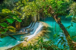
Ta Phin lies in a separate valley about 12 km from town and is home to Hmong and Red Dao families. It is known for Red Dao herbal baths, a mix of forest plants steeped in hot water, which make a good end to a cold walking day. Sin Chai is reached on foot from Cat Cat and stays far quieter. Cat Cat itself is the closest village to town and is now heavily set up for visitors, with a ticketed entrance, craft displays and photo spots. It is a fair introduction if you only have a few hours, but it is not the Sapa of quiet terraces.
Longer routes and homestay nights
Two or three day treks continue beyond Ta Van into valleys towards Ban Ho, where Bao Lao Cai notes that visitors can stay in stilt houses and eat local dishes, and where, as Dai Doan Ket has described, Hmong, Dao, Tay, Giay and Nung families live side by side. These routes have fewer people, more forest and more genuine farm life. They also need more planning: paths branch often, weather turns quickly and mobile signal can be patchy, which is one reason most people walk them with a guide.
Is Sapa trekking like walking in the Nepal hills?
Sapa trekking feels like a short, lower, busier version of a middle hills walk in Nepal, with wet rice terraces instead of mixed millet and maize fields and with roads never far away. If you have walked from Pokhara to Ghandruk, done the Poon Hill loop or hiked around Nagarkot, the slopes and village life will feel familiar, but the scale and remoteness are much smaller.
| Point | Sapa | Nepal middle hills |
|---|---|---|
| Starting height | Town about 1,600 m, a little above Kathmandu (about 1,400 m) | Varies widely, from under 1,000 m to well above 2,000 m |
| Highest point people reach | Fansipan, 3,147.3 m | Poon Hill alone reaches 3,210 m, and many treks go far higher |
| Typical walking day | Half day to one full day, mostly downhill into the valley with a vehicle back | Often six or more hours, with long climbs |
| Terraces | Wet rice paddies on very steep slopes, one crop a year | Rice lower down, millet, maize and potatoes higher up |
| Overnight stays | Homestays in family houses, plus hotels in town | Teahouses and lodges |
| Remoteness | Roads, motorbikes and new buildings on most routes | Many routes are still footpath only |
| Altitude sickness | Not a concern on valley walks; Fansipan by cable car is a fast climb to over 3,000 m | A real factor above about 2,500 m on longer treks |
Three points stand out for Nepali hikers. First, the Sapa terraces are steeper and more continuous than most of what you see in the Kathmandu valley rim walks, and in the green or golden season they genuinely look different from home, which is why people make the trip. Second, nobody should come to Sapa expecting Himalayan views: the mountains are forested ridges, not snow peaks, and cloud often hides them. Third, after years of teahouse trekking, you may find the walking easy and the crowds surprising. Choose the longer valley routes if you want something closer to a proper trek.
For a family with grandparents, Sapa can work better than a Nepal trek: the cable car, short walks and vehicle support make it possible to see terraces and a 3,000 metre summit without days of climbing. For anyone with heart or breathing problems, check with a doctor before going up Fansipan, because the cable car takes you from valley height to above 3,000 metres in around 20 minutes.
Who lives in the Sapa valleys?
The Sapa area is home to five ethnic minority communities, the Hmong, Dao, Tay, Giay and Xa Pho, as Bao Lao Cai lists them, living alongside Kinh (ethnic Vietnamese) families. In 2024 the former Sa Pa town had nearly 70,000 residents, more than 56,000 of them from ethnic minorities, according to a Bao Lao Cai report on the small Xa Pho community. On the trails, the people you meet most often are Hmong and Red Dao.
| Community | Where you are likely to meet them | What visitors often notice |
|---|---|---|
| Hmong | Cat Cat, Lao Chai and many hillside villages | Indigo clothing and handmade textiles, often sold along the trails |
| Red Dao | Ta Phin and other side valleys | Red headscarves worn by women; the herbal bath tradition |
| Giay | Ta Van on the valley floor | Farming families on the flatter, lower land |
| Tay | Ban Ho, where Hmong, Dao, Tay, Giay and Nung families live side by side | Stilt houses, some now used for homestays |
These are working farming communities, not a living museum, and each group has its own language, dress, festivals and beliefs. Many families now earn part of their income from tourism through guiding, homestays and textiles, and the pressure of millions of visitors is felt in the villages as much as in town. A few simple habits make your visit better for everyone:
- Ask before photographing people, especially children and older people, and accept a no.
- Buy textiles directly from the people who made or sell them, and agree a price calmly. A firm "no, thank you" is fine if you do not want to buy.
- Do not hand out sweets or money to children on the trail. If you want to help, buy from adults or support community run homestays.
- Dress modestly in villages, keep voices down near houses, and stay on paths through the rice, because a broken terrace wall is a family's lost harvest.
- In a homestay, follow the family's lead at meals and around the household altar.
Nepali travellers will recognise much of this from visiting Gurung, Magar or Tamang villages at home. The same courtesy applies, and it is noticed.
Should you trek with a local guide?
For short walks near town, such as Cat Cat or the main road along the Muong Hoa valley, many visitors go without a guide. For multi day treks and quieter routes, take a licensed local guide, and for any climb of Fansipan on foot a guide or porter is a requirement rather than a choice. Rules in Lao Cai province have tightened since 2025, so check the current position before you set out.
What the rules say
| Activity | Rule or requirement | Source and date |
|---|---|---|
| Climbing Fansipan on foot through Hoang Lien National Park | A permit to enter the forest and a guide or porter are described as the most important rules; climbers carry out all rubbish and must not light fires | Bao Lao Cai, 26 Oct 2025 |
| Visiting the Fansipan summit area and Cat Cat waterfall | A sightseeing fee applies to all visitors, Vietnamese and foreign, from 1 January 2025 | Bao Dau Tu, 28 Dec 2024 |
| Adventure services such as trekking and mountain guiding | Communes and wards must list providers of trekking guides, mountain guides and porters; accommodation providers and individuals may not run travel or adventure programmes without the proper licence | DTiNews, 6 Mar 2026 |
| Safety in outdoor and adventure tourism | Providers must classify routes by difficulty, check weather and ensure their guides are competent | Lao Cai tourism department guidance, Aug 2026 |
We could not find any rule that requires a guide for a day walk on the open village paths near town, and Vietnam's national tourism authority has long said that half day and full day hikes can be done without one, while recommending a guide for two or three days in the hills. Some villages and scenic spots, Cat Cat among them, sell entry tickets, so carry some cash. Checked: 5 Nov 2026.
Why a guide is worth it anyway
- Route finding: farm paths split constantly and change after landslides or construction, and most maps do not show them well.
- Weather judgement: fog can close in within minutes, and wet clay paths on steep terraces are genuinely slippery.
- Context: a guide from the valley can explain who farms which fields, what is planted when and how the villages live, which is the real value of walking here.
- Money in the right place: a guide from the local communities, working through a licensed operator, keeps more income in the villages you are walking through.
- Homestays: a guide can arrange a family homestay along the route, which is easier than finding one on foot at the end of a long day.
Ask any guide or company whether they are licensed for trekking in Lao Cai, what the route is, how the day will end (on foot or by vehicle), and what happens if the weather turns. Clear answers are a good sign.
Is Fansipan worth it?
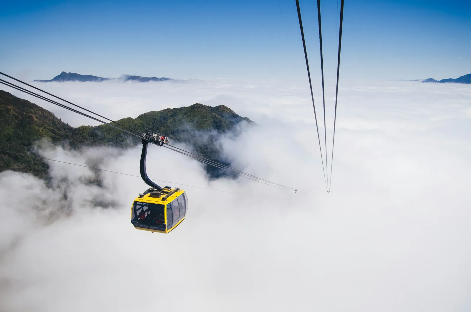
Fansipan is worth it on a clear day, either as a quick cable car trip for the view and the summit complex or as a multi day climb for keen hikers. On a cloudy day the cable car can take you up into a white-out, so watch the forecast and keep your plans flexible. The peak is the highest in Vietnam and in the whole Indochina region, which is why locals call it the Roof of Indochina.
How high is Fansipan?
Fansipan is 3,147.3 metres high, according to a 2019 survey by Vietnam's Department of Survey, Mapping and Geographic Information, which used satellite positioning to remeasure the summit. The older figure of 3,143 metres, measured by the French in 1909, had been used in official documents for about 110 years and still appears on many signs and websites, as VietnamPlus reported at the time. Either way, it is a little lower than Poon Hill in Nepal.
The Sun World Fansipan Legend cable car
The cable car, run by Sun World Fansipan Legend, opened in February 2016 and holds two Guinness World Records: the longest non-stop three-rope cable car, at 6,292.5 metres, and the greatest elevation difference for that type of cable car, at 1,410 metres between stations. The Guinness release gives a ride time of about 20 minutes, while Vietnam's government news portal says about 15 minutes, with cabins holding up to 35 people.
From Sapa town, a funicular railway runs about 2 km down to the Muong Hoa station near the cable car base, and a second funicular near the top shortens the final climb towards the summit. The last stretch still involves stairs and slopes past pagodas and statues, at over 3,000 metres, so take it slowly. The official Sun World Fansipan page lists opening hours of 7:30am to 5pm and notes that hours may change. A ticket is needed, and the summit area has been subject to a local sightseeing fee since January 2025, so check what your ticket includes when you buy. Checked: 5 Nov 2026.
Climbing Fansipan on foot
Climbing Fansipan on foot is a steep, demanding hike that tour operators usually plan over two or three days, although very fit hikers sometimes go up and down in one long day. A common starting point is Tram Ton, on the road up to the O Quy Ho pass; Nhan Dan puts the trail from Tram Ton to the summit at 16 km and notes that climbers register at the Nui Xe forest ranger station. Expect muddy forest, rock steps and cold, wet weather near the top in any season.
Bao Lao Cai describes a permit to enter the forest of Hoang Lien National Park and a guide or porter as the most important rules for the climb, and asks walkers to carry out every scrap of rubbish and never light fires. Bao Lao Cai reported that around 6,000 people climbed Fansipan by the land route in 2025 up to the end of October. For Nepali hikers used to multi day climbs, the height is modest, but the gradient is relentless and the trail is often slick, so good boots and poles matter more than altitude experience.
Cable car or hike: which one?
| Question | Cable car | Hike |
|---|---|---|
| Time needed | Half a day including queues and the summit area | Usually 2 to 3 days, sometimes 1 for very fit hikers |
| Fitness | Light walking and some stairs at altitude | Strong fitness, steep ascent and descent |
| Permits and guides | Ticket only | Forest entry permit plus a guide or porter |
| Who it suits | Families, older travellers, honeymooners, anyone short of time | Experienced hikers who want the mountain itself |
| What you get | Views over the cloud, the summit marker, temples and gardens | Forest, solitude in places, a real sense of the climb |
| Weather risk | Views lost in cloud, but you stay dry and warm in the cabin | Rain, cold and slippery rock, so go only with a good forecast |
A sensible plan for many travellers is to walk the valleys on foot and use the cable car for the summit on the clearest morning of the trip.
How do you get from Hanoi to Sapa?
You get from Hanoi to Sapa either by expressway bus straight to Sapa in about five and a half to six hours, or by overnight train from Hanoi to Lao Cai in about seven and a half to eight hours, followed by a 35 km road transfer up to Sapa. Sapa has no airport, so everyone arrives by road for the final stretch. Spend a day or two in the capital first; our list of things to do in Hanoi helps fill the time before your night train or bus.
Hanoi to Sapa transport options
| Option | Journey | Time | Good for | Watch out for |
|---|---|---|---|---|
| Sleeper or cabin bus | Hanoi, often from the Old Quarter, to central Sapa via the Hanoi to Lao Cai expressway | About 5.5 to 6 hours | Speed, door to door convenience, couples using double cabins | Limited legroom for tall travellers, winding final road, toilet stops only |
| Overnight train | Hanoi station to Lao Cai station | About 7.5 to 8 hours | A proper bed, smoother ride, saving a hotel night | Needs a 35 km transfer from Lao Cai to Sapa on arrival |
| Day train | Lao Cai to Hanoi only (SP8) | About 7.5 hours | Daylight views on the way back | Only runs in the Lao Cai to Hanoi direction |
| Private car or tour transfer | Hanoi or Noi Bai airport to Sapa via the expressway | Similar to the bus, depending on stops | Families, elderly parents, groups with luggage | Book through a licensed company |
Bus times come from a DTiNews comparison published in May 2026, which credits the Hanoi to Lao Cai expressway for roughly halving road journey times over the past decade.
Train timetable to Lao Cai
Since 10 October 2026, three pairs of passenger trains run daily between Hanoi and Lao Cai, after a new SP15 and SP16 pair joined the existing SP3, SP4, SP7 and SP8 services, as Bao Lao Cai reported on 11 October 2026.
| Train | Direction | Departs | Arrives |
|---|---|---|---|
| SP15 | Hanoi to Lao Cai | 9:45pm | 5:20am |
| SP3 | Hanoi to Lao Cai | 10pm | 5:50am |
| SP7 | Hanoi to Lao Cai | 10:40pm | 6:27am |
| SP16 | Lao Cai to Hanoi | 9:25pm | 5:15am |
| SP4 | Lao Cai to Hanoi | 9:50pm | 5:40am |
| SP8 | Lao Cai to Hanoi | 12:05pm | 7:30pm |
Timetables change, and services are added for Tet and cut in severe weather. In September 2024, Storm No. 3 (Typhoon Yagi) damaged the line, and passenger trains only resumed on 23 September 2024. Check the current schedule with Vietnam Railways before you travel, and keep a bus as a backup in the rainy season. Checked: 5 Nov 2026.
Getting to Hanoi from Kathmandu
There is no non-stop flight between Kathmandu and Hanoi, so travellers from Nepal connect, most often through Bangkok, with Kuala Lumpur, Singapore, Guangzhou and Kunming as other options. Our guide to direct flights from Kathmandu lists the main connecting routes and typical flying times. For entry rules, see our Vietnam visa guide.
If you land in Hanoi in the morning, an evening bus or night train can get you to Sapa the next morning without wasting a day. Many travellers from Nepal combine Sapa with the limestone bays of the north; our Ha Long Bay guide explains how to fit a cruise into the same trip.
What should you pack for Sapa weather?
Pack layers, a proper rain jacket and shoes with grip in any season, because Sapa is cool, damp and changeable all year, and much colder than Hanoi. Vietnam's national tourism site describes a cool highland climate with misty mornings, cold winters and occasional frost around Fansipan. Most rain falls in the summer months, which is also when the terraces are green, while autumn and early winter are drier and clearer.
Sapa weather by season
| Season | What to expect | What it means for walking |
|---|---|---|
| December to February | The coldest months: cold days, colder nights, frequent fog, occasional frost and very rare snow | Clear spells can be beautiful, but pack real warm layers and expect limited heating |
| March to April | Warming, generally mild, with rain starting to return in April | Good walking, terraces still between crops |
| May to September | The warm, wet season, with heavy showers and cloud, especially in July and August | Green terraces, but muddy, slippery paths and frequent cloud on Fansipan |
| October to November | Drier, cooler and often clear, with cold nights by November | Firm trails and good views, terraces harvested |
This is a general picture, not a forecast. Real days swing a lot: a sunny afternoon can feel warm, and a foggy evening can feel close to freezing, especially at the Fansipan summit, which is far colder than town. Check a local forecast a few days before you go, and again on the morning you plan to walk or ride the cable car.
Does it snow in Sapa?
Snow in Sapa town is rare but does happen during strong winter cold waves, while the Fansipan summit sees snow or frost more often. The most famous recent event came on 24 January 2016, when snow covered the town and the Lao Cai Hydro-Meteorological Forecasting Center recorded minus 3.2°C, which it called the lowest it had measured there. On the summit, snow fell on 26 January 2025 above 3,000 metres, as VietnamNet reported, after frost the previous November.
Do not plan a trip around seeing snow. It is unpredictable, short lived, and when it comes it brings icy roads, closed routes and crowds of domestic visitors rushing up from Hanoi. If you travel between December and February, the realistic picture is cold, often foggy days with clear spells, and a small chance of frost.
Sapa packing list
- Waterproof jacket: a real rain shell, not a thin poncho, for every season.
- Warm layer: a fleece or light down jacket; add a hat and gloves from November to March and for the Fansipan summit at any time.
- Footwear: trail shoes or light boots with good grip. Valley clay becomes like soap after rain, and Fansipan on foot needs boots.
- Trekking poles: very useful on steep terrace descents. Shops in Sapa town sell and rent gear if you prefer not to carry your own.
- Quick dry clothes: cotton stays wet for days in the humid summer.
- Dry bags or plastic liners: for your phone, passport and spare clothes.
- Sun protection: sunscreen, sunglasses and a cap, because the sun is strong at height even when it feels cool.
- Insect repellent: for forest trails and homestay evenings in the wet months.
- Small cash: for village tickets, snacks, drinks and handicrafts.
- Personal medicines: including anything for motion sickness on the mountain road.
- A light day pack: homestays usually provide bedding and towels, so you can leave the big bag in town.
Travellers flying from Kathmandu in October or November should pack a proper warm layer even if Hanoi is still warm. Sapa nights at that time of year can feel like Kathmandu in December.
Planning your Sapa trip: food, stays and honest tips
Plan at least two nights in Sapa, ideally three, so you have one day for a valley trek, one for Fansipan or a second walk, and some slack for weather. Stay in a valley homestay for atmosphere, or in town for comfort and easy transport, and avoid Vietnamese holiday weekends if you can. The notes below cover food, accommodation and a few lessons that generic guides tend to skip.
What to eat in Sapa
Sapa's mountain food is quite different from Hanoi street food. Bao Lao Cai's guides to Sapa specialities and local dishes list thang co, a traditional Hmong soup of horse meat, offal and bones; farmed salmon, often in hotpot, and sturgeon; black chicken grilled with honey; smoked dried buffalo; com lam, sticky rice cooked in bamboo tubes; chestnut cakes; con sui noodle soup; and wine made from tao meo mountain apples.
- For Nepali travellers who avoid beef: the smoked dried meat sold everywhere is usually labelled as buffalo, but always ask, and check hotpot broths and mixed grills.
- For vegetarians: com lam, grilled corn, sweet potatoes, chestnuts, tofu and stir fried mountain greens are easy to find. Say clearly that you do not eat meat or fish sauce, and a homestay host will usually cook separately if told in advance.
- Thang co: it is a traditional dish with real cultural meaning in the highlands, but it contains horse meat and offal, so know what you are ordering.
For the wider picture of Vietnamese cooking and what to try in the cities, see our guide to what to eat in Vietnam.
Where to stay: town or valley?
| Base | Pros | Cons |
|---|---|---|
| Sapa town centre | Easy bus and train transfers, restaurants, the Fansipan funicular nearby, wide choice of hotels | Construction, traffic and crowds; views often lost in cloud |
| Muong Hoa valley (Ta Van and around) | Terrace views from the door, trekking starts at the gate | Busy in peak weeks, steep access roads |
| Ta Phin or quieter valleys | Calmer, closer to village life, herbal baths | Fewer services, transport needs arranging |
| Homestay deeper in the valleys | The most memorable nights, family meals | Simple facilities, shared bathrooms, limited heating in winter |
Honest tips we would give a friend
- Do not judge Sapa by the town. The centre is crowded and heavily built up. Walk out of it as soon as you can.
- Keep the plan flexible. Fog can sit on Sapa for days. Put Fansipan on the clearest morning, not a fixed date.
- Book early for September and holidays. Harvest weekends, Tet and the late April holiday fill trains, buses and good homestays.
- Allow for the road. The final climb from Lao Cai, or the expressway exit, is winding. Take motion sickness tablets if you need them.
- Combine wisely. Sapa works well with Hanoi and Ha Long Bay on a northern loop. For a sense of how many days to give each region, our Vietnam itinerary guide shows realistic routes that also cover the centre and south of the country.
- Elderly parents and young children: choose a town hotel with lift access, short walks to Cat Cat or a valley viewpoint, and the cable car for the summit, rather than long treks.
- Honeymooners: a valley hotel with terrace views and a clear Fansipan morning is the classic pairing; avoid the July and August rain if you want views.
If you would rather have the trains, transfers and stays arranged around a wider trip to the north and the rest of the country, you can browse Vietnam tour packages and adapt one to include Sapa.
Frequently asked questions about Sapa
Is Sapa worth visiting?
Yes, Sapa is worth visiting if you want rice terraces, village walks and mountain air, especially from late April to May or from July to October. Be ready for a crowded, heavily built up town centre. The rewards are in the valleys around it, such as Muong Hoa, Ta Van and Ta Phin, which still feel like farming country.
When are Sapa rice terraces golden?
Sapa rice terraces are golden mainly in September, as the single yearly crop ripens, with the harvest running into late September and early October. Exact timing shifts with altitude and weather. For the best chance, travel in the first three weeks of September. By Dashain and Tihar, most Sapa fields have already been harvested.
Is Sapa trekking difficult?
Most Sapa trekking is easy to moderate: half day or full day walks on farm paths and village lanes, usually downhill into the valley with a vehicle back. The hard parts are steep, muddy descents after rain. Climbing Fansipan on foot is a different matter, a steep hike usually spread over two or three days that needs good fitness.
Do I need a guide in Sapa?
You do not need a guide for short walks near Sapa town, such as Cat Cat village. A forest entry permit and a guide or porter are required to climb Fansipan on foot through Hoang Lien National Park. For multi day treks and quieter routes, a licensed local guide is strongly recommended. Check current Lao Cai rules before going.
How do I get from Hanoi to Sapa?
The two main ways from Hanoi to Sapa are an expressway bus straight to Sapa town, about 5.5 to 6 hours, or an overnight train to Lao Cai, about 7.5 to 8 hours, followed by a 35 km road transfer. Since October 2026, three trains run each way daily, most of them overnight. Sapa has no airport.
Is Sapa cold in winter?
Yes, Sapa is cold in winter. December to February are the coldest months, with chilly days, cold nights, frequent fog and occasional frost, and in January 2016 the local weather centre recorded minus 3.2°C in town, its lowest reading there. Indoor heating is limited in many homestays. Pack a warm jacket, hat and gloves, and expect the Fansipan summit to be far colder than town.
What is Fansipan?
Fansipan is the highest mountain in Vietnam and in Indochina, standing 3,147.3 metres high according to a 2019 government survey, though the older 3,143 metre figure is still widely quoted. It rises above Sapa in Hoang Lien National Park. You can reach the summit area by the Sun World cable car or climb it on foot.
Can it snow in Sapa?
Yes, it can snow in Sapa, but it is rare in town. The best known recent case was 24 January 2016, when snow covered Sapa and the temperature fell to minus 3.2°C. The Fansipan summit gets snow or frost more often, as on 26 January 2025. Snow cannot be predicted far ahead, so do not plan around it.
Is Sapa similar to Nepal hills?
Sapa feels similar to Nepal's middle hills in its steep terraced slopes and village life, and Sapa town sits a little above the height of Kathmandu. The differences are steeper wet rice terraces, shorter walking days, far more roads and crowds, and no snow peaks. Fansipan, at 3,147 metres, is slightly lower than Poon Hill.
Is Sapa still in Lao Cai province after the 2025 merger?
Yes. In 2025 Vietnam merged Yen Bai and Lao Cai into a single province that kept the name Lao Cai, and the old Sapa town became Sa Pa ward. The trekking valleys now fall under communes such as Ta Van, Ta Phin and Ban Ho. For visitors, nothing changed on the ground.
How many days do you need in Sapa?
Two to three nights in Sapa is a good minimum. That gives one day for a valley trek such as Lao Chai to Ta Van, one day for Fansipan or a second walk, and spare time if fog or rain spoils a day. Keen trekkers can add two or three days on longer homestay routes towards Ban Ho.
Sapa kasto thau ho?
Sapa is a cool mountain town in northern Vietnam, surrounded by terraced rice valleys and villages of Hmong, Red Dao, Giay and Tay communities. For Nepali travellers it feels a little like our middle hills, a little higher than Kathmandu, with easy village walks, family homestays and a cable car up Fansipan, Indochina's highest peak.