+977-9768558250
Explore by Country
See all 22 Thailand packages
Most popular pick
See all 22 Thailand packages →
See all 11 Vietnam packages
Most popular pick
See all 11 Vietnam packages →
See all 10 Indonesia (Bali) packages
Most popular pick
See all 10 Indonesia (Bali) packages →
See all 7 Maldives packages
Most popular pick
See all 7 Maldives packages →
See all 10 China packages
Most popular pick
See all 10 China packages →
See all 13 Sri Lanka packages
Most popular pick
See all 13 Sri Lanka packages →
See all 9 Malaysia packages
Most popular pick
See all 9 Malaysia packages →
See all 8 Singapore packages
Most popular pick
See all 8 Singapore packages →
See all 2 Kenya packages
Most popular pick
See all 2 Kenya packages →
See all 16 India packages
Most popular pick
See all 16 India packages →
See all 3 Dubai packages
Most popular pick
See all 3 Dubai packages →
See all 7 Nepal packages
Most popular pick
See all 7 Nepal packages →
See all 6 Philippines packages
Most popular pick
See all 6 Philippines packages →
Search Tours or Places
Blog / Kenya

Mount Kilimanjaro from Kenya: Amboseli Views and Climb Basics

26 min read 29 Oct 2026
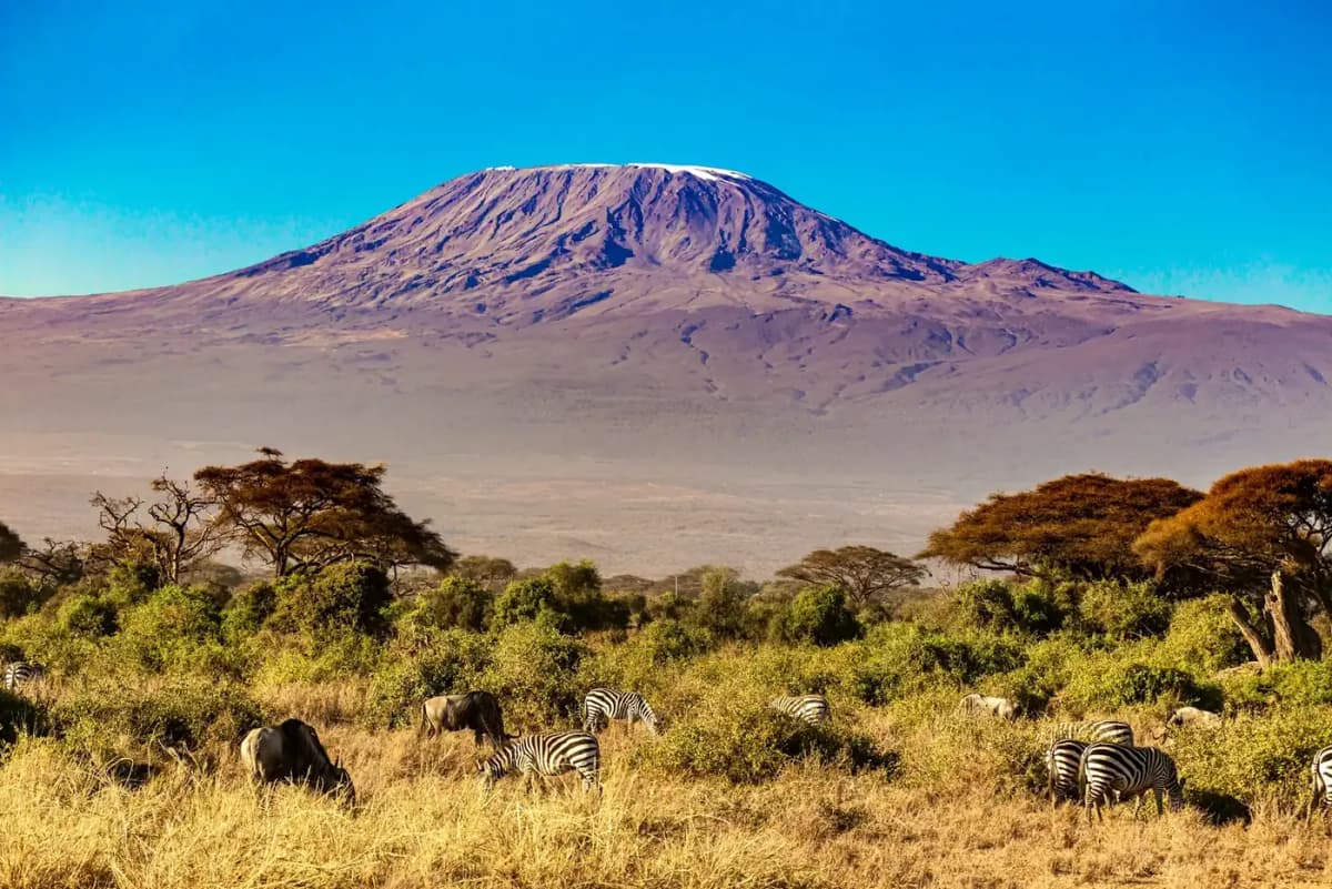
Snow capped Mount Kilimanjaro rising above acacia plains and grazing zebras in southern Kenya

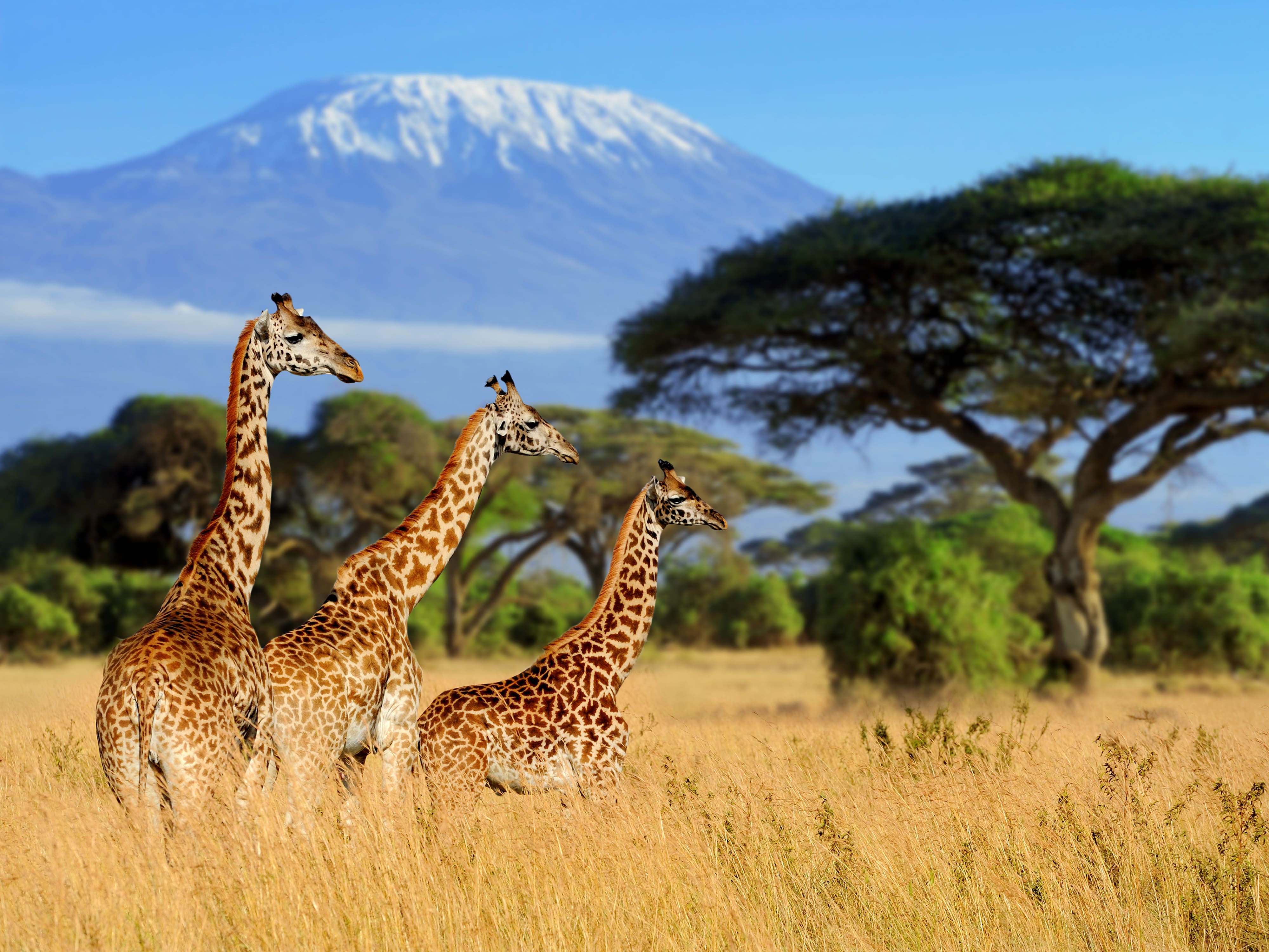
Short answer: Mount Kilimanjaro stands in northern Tanzania, just south of the Kenya border, but the classic view of Kilimanjaro is from Kenya's Amboseli National Park, where the snow-capped summit rises behind herds of elephants. You see it best on clear days in the early morning and in the afternoon, and more often in the drier months between the rains. You cannot climb it from Kenya, though: every climbing route starts from a gate on the Tanzanian side, so a climb means crossing the border.

This guide is written for two kinds of traveller. The first is the safari visitor who wants that famous photograph of Kilimanjaro above the plains of Amboseli. The second is the Himalayan trekker, often from Nepal, who has walked to Everest Base Camp or Annapurna and wonders whether Africa's highest mountain is the next step. We cover where the mountain is, when and where you can see it from Kenya, how a climb compares with a Nepal trek, which routes exist, and how a climb can fit around a Kenya safari.

If you are still building the bigger picture of the country, start with our complete Kenya travel guide and come back here for the mountain.

Quick factAnswerSource
CountryTanzania (Kilimanjaro National Park, Kilimanjaro Region)Tanzania National Parks (TANAPA)
Summit height5,895 m at Uhuru Peak on KiboTANAPA; UNESCO World Heritage listing
Best place to see it from KenyaAmboseli National Park, southern KenyaKenya Wildlife Service (KWS)
When it is clearestClear days, early mornings and afternoonsKWS
Can you climb from Kenya?No. All climbing gates are on the Tanzanian sideTANAPA visitor guide
Typical climb length5 to 8 days to the summit area, depending on routeTANAPA
Guide needed?Yes. All climbs must be guided by a licensed operator; solo trekking is not permittedTANAPA visitor guide

Where is Mount Kilimanjaro?

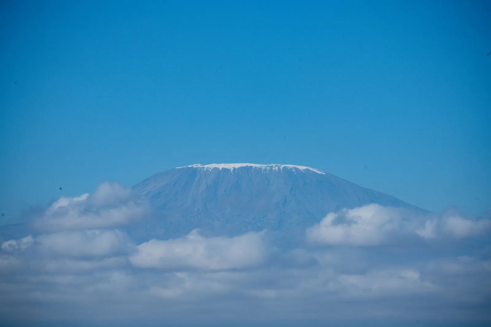
Snow capped summit of Mount Kilimanjaro rising above a band of clouds in Tanzania

Mount Kilimanjaro is in north-eastern Tanzania, close to the border with Kenya, inside Kilimanjaro National Park. The park headquarters is at Marangu in the Moshi District of Kilimanjaro Region, and the nearest international airport is Kilimanjaro International Airport (JRO), about 40 km from the park according to Tanzania National Parks (TANAPA).

The confusion about which country it belongs to is understandable. Most of the famous photographs of Kilimanjaro are taken from Kenya, looking south across Amboseli. The mountain itself, however, is entirely Tanzanian. UNESCO, which inscribed Kilimanjaro National Park as a World Heritage Site in 1987, describes it as a volcanic massif that "stands in splendid isolation above the surrounding plains", with its snowy peak looming over the savannah. UNESCO puts the rise at 4,877 m above the surrounding plains, and that isolation is why it dominates the horizon from so far away in Kenya.

What exactly is "Kilimanjaro"?

Kilimanjaro is not a single cone but a massif. TANAPA describes it as two dormant volcanoes and one extinct one:

PeakHeight (TANAPA)What it is
Kibo (Uhuru Peak is its summit)5,895 mDormant volcano; the highest point in Africa and the goal of almost every climb
Mawenzi5,149 mDormant volcano; a jagged, rocky peak to the east of Kibo
Shira3,962 mExtinct volcano; the Shira Plateau on the western side, which TANAPA describes as a vast high caldera of moorland, carries its name

TANAPA says the name is often explained as a mix of the Swahili word kilima (mountain) and the KiChagga word njaro, loosely "whiteness", giving "White Mountain", although it also notes that the true origin is not well known.

A simple location note for readers in Nepal

Picture Kenya and Tanzania side by side on the east coast of Africa. Nairobi, Kenya's capital, sits in the south-central part of the country. Amboseli is about 200 km from Nairobi by road, according to the Kenya Wildlife Service, in the far south near the Tanzanian border. Kilimanjaro rises just across that border. The towns climbers use as bases, Moshi and Arusha, are on the Tanzanian side and are served by Kilimanjaro International Airport and Arusha Airport. So the view is Kenyan; the mountain and the climb are Tanzanian. Our Tanzania travel guide covers that side of the border in detail.

Can you see Kilimanjaro from Kenya?

Yes, you can see Kilimanjaro from Kenya, and Amboseli National Park is the place to do it. The Kenya Wildlife Service says the Amboseli landscape is dominated by Mt. Kilimanjaro and the elephants gathering around the swamps, and that on clear days the mountain is clearly visible during early mornings and afternoons. The honest catch is the phrase "on clear days": on many days the upper mountain is wrapped in cloud.

Amboseli lies in southern Kenya, in Kajiado County, close to the Kenya and Tanzania border, and covers part of an ancient (Pleistocene) lake basin. KWS explains that water springs associated with Kilimanjaro give rise to several swamps in the park, such as Enkong Narok. That is the link between the mountain and the wildlife: water from Kilimanjaro feeds the swamps, the swamps draw the elephants, and the elephants stand in front of the mountain. Our full Amboseli National Park guide explains the park itself, its wildlife and where to stay.

Why the view is so dramatic

From Amboseli the ground is almost flat, and Kilimanjaro rises thousands of metres above it with no other mountains in front. Visitors who have seen the Himalaya from Nagarkot or Pokhara will notice the difference straight away. In Nepal, big peaks usually appear as one ridge among many. Kilimanjaro appears as a single, enormous dome on its own, with its summit ice catching the first and last light.

What you will not see from Kenya

Be realistic about what the view shows. From Amboseli you see the broad northern side of Kibo and, depending on your position and the cloud, Mawenzi's darker spires to the left. You do not see climbers, camps or trails, and the mountain is far enough away that a long lens helps for close photographs. It is quite possible to spend two days in Amboseli and never see the summit at all if cloud sits on it from morning to evening. Plan for at least two mornings in the park if the view matters to you.
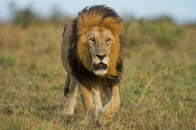
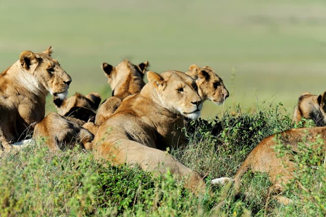
Explore Kenya tour packages
View all →

When is the best time to see Kilimanjaro from Amboseli?

The best time to see Kilimanjaro from Amboseli is in the early morning and again in the afternoon, ideally during Kenya's drier months between the two rainy seasons. That is the pattern KWS gives for clear days. The rains matter because more rain usually means more cloud on the mountain.

The Kenya Meteorological Department describes two rainy seasons: the "Long Rains" of March, April and May, and the "Short Rains" of October, November and December. Kajiado County, where Amboseli is, falls in the department's South-eastern Lowlands region. Start and end dates shift every year, so treat the months as a guide rather than a timetable. Checked: October 2026, Kenya Meteorological Department seasonal forecasts.

Time of dayWhat to expectPractical tip
Early morningKWS names early mornings as a time the mountain is clearly visible on clear daysBe at your viewpoint or on the road as early as the park and your lodge allow
AfternoonKWS names afternoons as the second window on clear daysKeep the afternoon free and return to an open area with the mountain to the south
Season (Kenya Meteorological Department naming)Months, approximatelyChances of a Kilimanjaro view
Drier months after the Short RainsJanuary to FebruaryBetter: less rain usually means less cloud
Long RainsMarch to MayLower: the wettest season, with more cloud on the mountain
Drier months between the rainsJune to SeptemberBetter: less rain usually means less cloud
Short RainsOctober to DecemberMixed: more cloud than the dry months, but clear early mornings still happen

Check park opening hours and rules on driving inside the park with your lodge or driver guide before planning a very early or late drive. Management of Amboseli is also in transition: the national government handed day-to-day management to Kajiado County Government in November 2025, and in July 2026 Kenya's High Court temporarily halted the county takeover while the dispute is heard, so who runs the gates and what the rules are may change. Checked: October 2026, The Star (Kenya).

The Dashain and Tihar question

Many travellers from Nepal travel during the Dashain and Tihar holidays, which usually fall in October and November. That window overlaps the start of the Short Rains in southern Kenya. It does not rule out a view, and clear early mornings still happen in the rainy months. It does mean you should not plan a one-night visit to Amboseli and expect a guaranteed photograph. Two nights give you two mornings and two afternoons, which improves your odds. For a month-by-month view of the wider country, see our guide to the best time to visit Kenya.

How to improve your chances

  • Stay at least two nights. It doubles your viewing windows, and it is the factor you control most easily.
  • Check the sky at first light. If the summit is out, go straight to an open area; cloud can return quickly.
  • Keep the afternoon free. KWS names afternoons as the second clear window, so a hidden morning is not the end of your chances.
  • Bring a zoom lens or binoculars. The mountain is huge but far away.
  • Accept the weather. Nobody can promise a view of Kilimanjaro, including your guide or your lodge.

Where in Amboseli are the best views of Kilimanjaro?

The best views of Kilimanjaro in Amboseli come from Observation Hill, from the open plains and swamp edges around Ol Tukai and Enkong Narok, and, weather permitting, from the air on a balloon flight. KWS lists Observation Hill (also called Nomatior) as offering a panoramic view of the park, names Ol Tukai and the swamps among the park's main features, and points to Lemomo Hill, just outside the park, as a high viewpoint.

ViewpointWhy it worksBest timeGood to know
Observation Hill (Nomatior)A raised viewpoint with a panoramic view over the swamps and plains towards the mountainEarly morning or late afternoonKWS says the hike up is worth the effort
Enkong Narok and the permanent swampsKWS describes elephants congregating around the swamps, which puts wildlife in the foreground with Kilimanjaro behindEarly morning or afternoonA popular setting for "elephants and Kilimanjaro" photographs
Ol Tukai areaKWS calls it a cool oasis of trees favoured by elephants and lions; open ground nearby faces the mountainDawn and duskOl Tukai Lodge, one of the private lodges KWS lists, is in this area
Lemomo HillKWS calls it the highest observation point, with the best views of the parkClear morningsIt is in Kitenden conservancy, about 3 km outside the park boundary (KWS); ask your driver guide about access
Lake Amboseli (dry lake bed)Wide, flat foreground; KWS notes the lake floods in heavy rains and attracts flamingosEarly, before heat hazeKWS describes it as a temporary lake, so expect a dry bed outside heavy rains
Balloon safariAn aerial view across the plains with the mountain in the distanceSunrise flightsKWS lists balloon safaris among park activities; availability depends on operators and weather

Observation Hill in more detail

Observation Hill is a popular stop and a good place to orient yourself. From the top you look over the green swamps, the pale dry lake bed and the scattered herds, with Kilimanjaro filling the southern sky on a clear day. It is also a chance to stretch your legs after hours of viewing from a vehicle. Bring water and a hat for the walk up. Follow your driver guide and the KWS rangers on where you may walk.

Getting to Amboseli for the view

KWS gives three main access gates: Iremito, Kimana and Meshanani. From Nairobi it lists 204 km via Emali to Iremito Gate on the Nairobi to Mombasa road, and 220 km via Namanga to Meshanani Gate, tarmac to Namanga and murram (gravel) after that. There is also a tarmacked airstrip, Kimana, for light aircraft. Checked: October 2026, Kenya Wildlife Service. Many visitors arrive by road from Nairobi as part of a wider safari circuit; our Nairobi travel guide helps with the start of the trip.

How hard is a Kilimanjaro climb for someone who has trekked in Nepal?

For a fit trekker who has already been to Everest Base Camp, a Kilimanjaro climb is not technically harder, but it is often harder on the body because you go higher, faster. The summit, at 5,895 m, is roughly 500 m above Everest Base Camp, and most Kilimanjaro routes reach it in 5 to 8 days, while a typical Everest Base Camp trek spends more days climbing to a lower top. There is no rock climbing or ropework on the standard routes. The challenge is altitude, cold and the long summit day.

Kilimanjaro vs Everest Base Camp: the altitude comparison

The table puts the two side by side. Kilimanjaro heights come from TANAPA where it gives them; camp and hut heights come from published altitude studies, because TANAPA does not list them on its park pages. Everest Base Camp moves with the Khumbu Glacier, so published studies give heights from about 5,300 m to 5,400 m; the CDC Yellow Book uses "approximately 5,400 m" for Everest base camp and "approximately 5,900 m" for Kilimanjaro.

PlaceApproximate altitudeSource
KathmanduAbout 1,300 to 1,400 mPublished altitude studies (several use 1,300 m or 1,400 m)
Moshi, Tanzania (climbing base town)About 950 mPublished Kilimanjaro study (Respiratory Physiology and Neurobiology, 2018)
Namche Bazaar, NepalAbout 3,440 mPublished Everest trek study (Frontiers in Genetics, 2019)
Shira Camp, KilimanjaroAbout 3,505 mPublished Kilimanjaro study, 2018
Kibo Hut, Kilimanjaro (Marangu route)About 4,730 mPublished Kilimanjaro study (High Altitude Medicine and Biology, 2010)
Barafu Camp, Kilimanjaro (common high camp)About 4,837 mPublished Kilimanjaro study, 2018
Gorak Shep, NepalAbout 5,160 mPublished Everest trek study, 2019
Everest Base Camp, NepalAbout 5,300 to 5,400 m (the camp sits on a moving glacier)CDC Yellow Book; published studies
Uhuru Peak, Kilimanjaro summit5,895 mTANAPA; UNESCO

Why the faster ascent matters

The CDC's guidance for travellers is that once you are above 3,000 m you should raise your sleeping altitude by no more than 500 m a day, and add an extra acclimatisation day for every additional 1,000 m of sleeping altitude gained. Many Kilimanjaro itineraries go faster than that, especially the shorter versions of the routes, and then make a summit push of well over 1,000 m from the high camp.

The research on Kilimanjaro is sobering. A study of 312 trekkers on the Marangu route, published in Wilderness and Environmental Medicine, recorded acute mountain sickness (AMS) in 77% of those with complete data, and a summit rate of 61%. Its authors concluded that the risk of AMS on Kilimanjaro is high and that trekkers ideally need a more gradual route profile. A smaller study on the six-day Machame route found AMS on summit day in 86% of 28 trekkers. A study of 175 trekkers on a six-day Rongai ascent recorded a lower AMS rate and an 88% summit rate than earlier work on four and five-day ascents. The pattern is consistent: more days on the mountain means better acclimatisation and a better chance of reaching the top.

Does your Nepal experience help?

Yes, with limits. The CDC says that how you previously responded to high altitude is the most reliable guide for future trips, but only when the altitude and ascent rate are similar, and even then it is not a perfect predictor. If you walked to Everest Base Camp slowly and felt well, that is encouraging; it does not prove you will feel well on a faster, higher Kilimanjaro ascent. The Edinburgh study of Kilimanjaro climbers also found significantly less AMS among people who were already acclimatised before the climb, which is a point in favour of arriving from a high place rather than straight from sea level. The CDC suggests that spending two or more nights above 2,750 m before a trip is useful preparation; Kathmandu, at around 1,300 to 1,400 m, is well below that, so time in the hills matters more than time in the city.

FactorEverest Base Camp trek (Nepal)Kilimanjaro climb (Tanzania)
Highest pointAbout 5,300 to 5,400 m at base camp5,895 m at Uhuru Peak
Ascent profileUsually gradual, with acclimatisation days on the way upUsually faster; 5 to 8 days to the summit depending on route (TANAPA)
Summit dayA walk to base camp and back to Gorak Shep, in daylightA long push of over 1,000 m from the high camp to the summit, followed by a long descent; ask your operator what time it starts
Technical difficultyNon-technical trekkingNon-technical on the standard routes
AccommodationTeahouses and lodgesHuts on the Marangu route; tented camps on other routes (TANAPA)
Guide rulesSet by Nepal's authorities; check current trekking rulesAll climbs guided by a licensed operator; no solo trekking (TANAPA)
Climate zonesForest to high alpineUNESCO describes five main vegetation zones, from the lower slopes through forest and moorland to alpine desert and the summit

Practical points for Himalayan trekkers

  • Choose more days, not fewer. The studies above all point the same way. If an itinerary looks fast, ask how many nights you sleep above 3,500 m before the summit night.
  • Expect a long, cold summit day. TANAPA highlights the famous sunrises from Uhuru Peak, and its safety advice is to carry proper cold-weather and rain gear, a headlamp and personal medicines. Ask your operator what time the summit push starts and pack for the coldest conditions of the trip.
  • Know the warning signs. The CDC's advice is simple: descend if symptoms get worse despite rest or treatment at the same altitude.
  • Talk to a doctor before you go. Medicines for altitude sickness are prescription decisions. The CDC notes that some climbers use preventive medication for summit day on peaks like Kilimanjaro; that is a conversation for your doctor, not a blog.
  • Check your insurance covers high-altitude trekking. Some policies set an altitude limit or exclude high-altitude trekking. Our guide to travel insurance from Nepal explains what to look for.
  • Older climbers and parents. A small 2018 study of an 11-day Kilimanjaro trek found that mild lung fluid at the high camp tended to be more common in older adults than younger ones, though the difference was not statistically significant and the fluid stayed subclinical. The six-day Rongai study above also found that trekkers aged 40 and over reached the summit less often. Age is not a bar, but older family members should get a medical check and choose a longer route.

Which Kilimanjaro climbing routes are there?

TANAPA says six mountain trails lead to the summit of Kilimanjaro and that reaching Kibo takes 5 to 8 days depending on the route, adding that "the more days, the higher the possibility to conquer the summit". Its visitor guide names the main gates as Marangu, Machame, Lemosho (reached via Londorossi) and Rongai in the north, with Mweka Gate used for the descent. Checked: October 2026, TANAPA.

Routes can close at short notice. In late September 2026 TANAPA temporarily suspended the Lemosho and Londorossi routes because of a wildfire on the western slopes, as reported by Tanzania's Daily News, and announced their reopening on 8 October 2026. Ask your operator to confirm that your route is open before you travel.

The routes below are the ones named by TANAPA's visitor guide. Durations vary by operator and by how many acclimatisation days you add, so we show TANAPA's overall range and, where we found one, the ascent length used in a published study. We have not invented day counts where no reliable source gave one.

RouteStarts fromNights on the mountain inDays (sourced)Character
MaranguMarangu Gate, south-eastAlpine huts: Mandara, Horombo, Kibo (TANAPA)4 or 5-day ascents in one published study; longer versions add a rest dayThe only hut route; the fast versions studied showed a high AMS rate
MachameMachame Gate, south-westTented camps6-day version studied in published researchIncludes a 'sleep low' night after climbing higher on day three, as described in the published study
LemoshoLemosho, reached via Londorossi, westTented camps; crosses the Shira PlateauWithin TANAPA's 5 to 8-day rangeLong western approach across the Shira Plateau, which TANAPA describes as a high caldera of moorland
RongaiNorthern side (TANAPA)Tented camps6-day ascent in one published studyApproaches from the north, the side of the mountain that faces Kenya
MwekaMweka Gate, southDescent onlyNot an ascent routeTANAPA says Mweka Gate is used for the descent

TANAPA counts six trails in all, but its park pages name only the gates above. Operators sell further route names and variations; treat the descriptions here as a guide and confirm current routes and rules with a licensed operator before you book.

Which route suits a Nepal trekker?

If you have done Everest Base Camp, the Annapurna Circuit or a similar trek, you will be comfortable with the daily walking on any of these routes. The bigger question is how quickly you gain height. Longer itineraries, with extra nights before the summit push, give more time to adjust, and the published research suggests that is what improves both comfort and summit success. If you prefer a roof over your head and a lodge feel closer to a Nepal teahouse, Marangu's huts are the nearest thing, but choose a version with an extra acclimatisation day.

The climbing season

Kilimanjaro is open all year; TANAPA describes the park as open year-round. The Tanzania Meteorological Authority places Kilimanjaro Region in the North Eastern Highlands, one of its "bimodal" areas with two rainy seasons: the heavier Masika rains from about mid-March to May, and the shorter Vuli rains from about October to December. The drier windows between them, roughly January to early March and June to September or early October, are the usual climbing seasons. TANAPA's safety advice to carry cold-weather and rain gear applies in every month.

PeriodRain pattern (Tanzania Meteorological Authority)What it means for a climb
January to early MarchBetween the two rainy seasonsA common choice for climbs
Mid-March to MayMasika, the long and heavier rainsWettest and quietest; muddy forest trails and more cloud
June to SeptemberGenerally dryA common choice for climbs; pack for cold nights
October to DecemberVuli, the shorter rainsPossible but more variable; expect wetter trails and more cloud

The shrinking ice on the summit

TANAPA describes Kibo as snow-covered all year, and the summit ice fields such as the Furtwängler and Rebmann glaciers are still there. They are shrinking fast. A 2009 study in the Proceedings of the National Academy of Sciences found that 85% of the ice cover present in 1912 had disappeared, and 26% of the ice present in 2000 was gone by 2007. A 2013 mapping study in The Cryosphere measured the ice area at 11.40 square kilometres in 1912 and 1.76 square kilometres in 2011, again about 85% lost, and judged it highly unlikely that the ice would persist beyond 2060 if current conditions continue. A 2022 report by UNESCO and IUCN said glaciers in all African World Heritage sites, including Kilimanjaro National Park, will very likely be gone by 2050.

For travellers this has two practical meanings. The white summit you see from Amboseli is smaller than in older photographs, and it will not look the same in a few decades. And if seeing ice on Africa's highest mountain matters to you, there is no reason to put the trip off.

How do you combine Kilimanjaro with a Kenya safari?
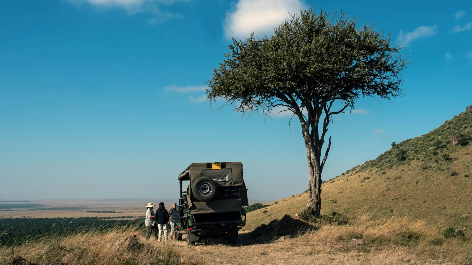
Safari vehicle and two travellers beside a lone acacia tree on the open plains of Kenya

The simplest way to combine Kilimanjaro with a Kenya safari is to see the mountain from Amboseli on the Kenyan side, and, if you also want to climb, add a separate climb in Tanzania before or after the safari. Amboseli gives you the view without any border crossing. A climb means entering Tanzania and starting from one of TANAPA's gates, usually from Moshi or Arusha.

Three ways to build the trip
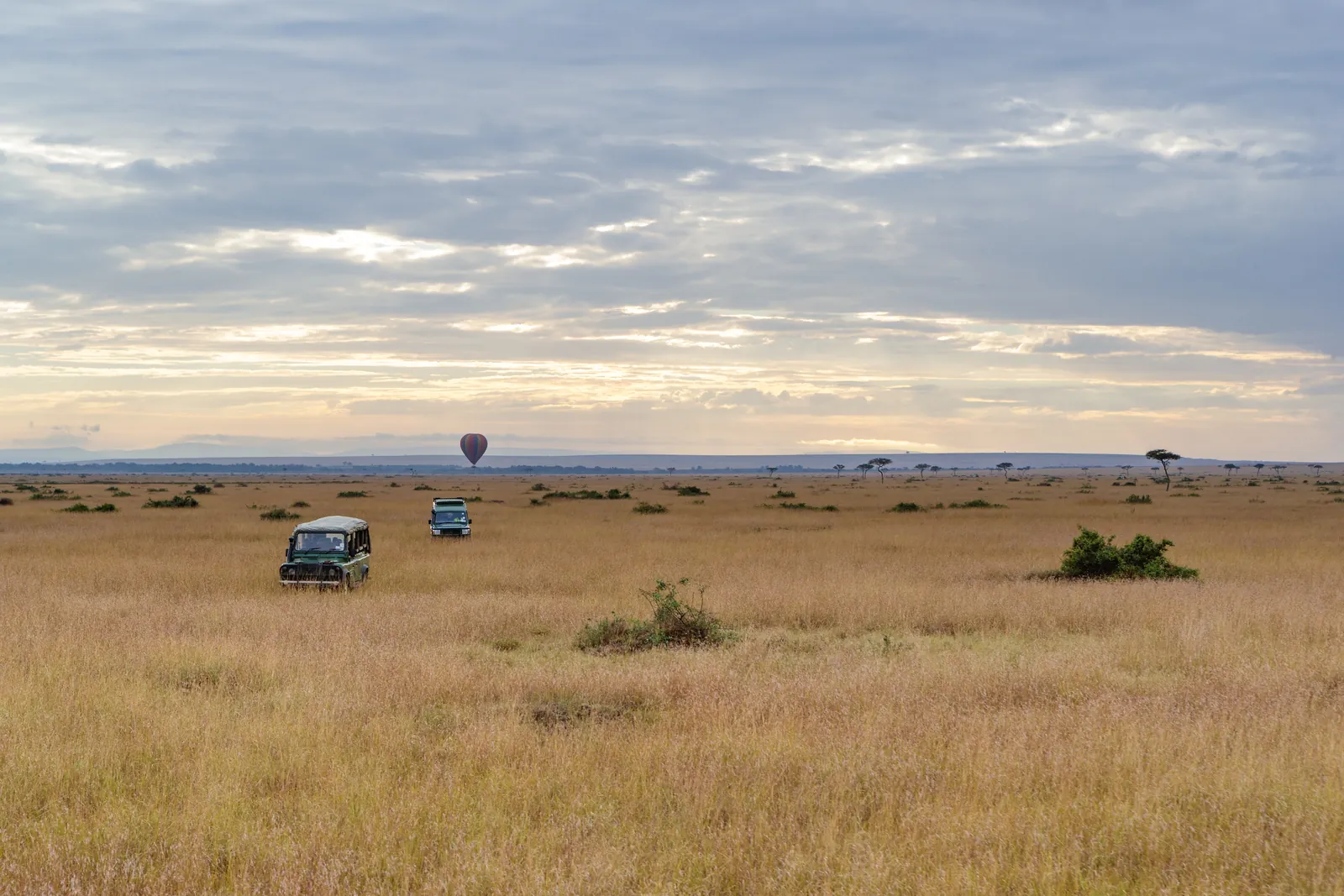
Two safari vehicles spaced far apart on open golden savannah under a wide Kenyan sky
OptionWho it suitsWhat it involvesHonest downside
View only: Amboseli as part of a Kenya safariFamilies, couples, first-time safari travellers, elderly parentsTwo nights in Amboseli inside a wider route with the Masai Mara or other parksA view is never guaranteed; cloud can hide the mountain for days
Climb first, then safariTrekkers who want to rest and celebrate afterwardsFly into the Kilimanjaro side, climb, then cross to Kenya for the safariTired legs on long game drives; plan a rest day
Safari first, then climbTravellers who want the climb as the finaleKenya safari ending near Amboseli, then cross into Tanzania for the climbEasy to underestimate how much the climb needs rest and preparation beforehand

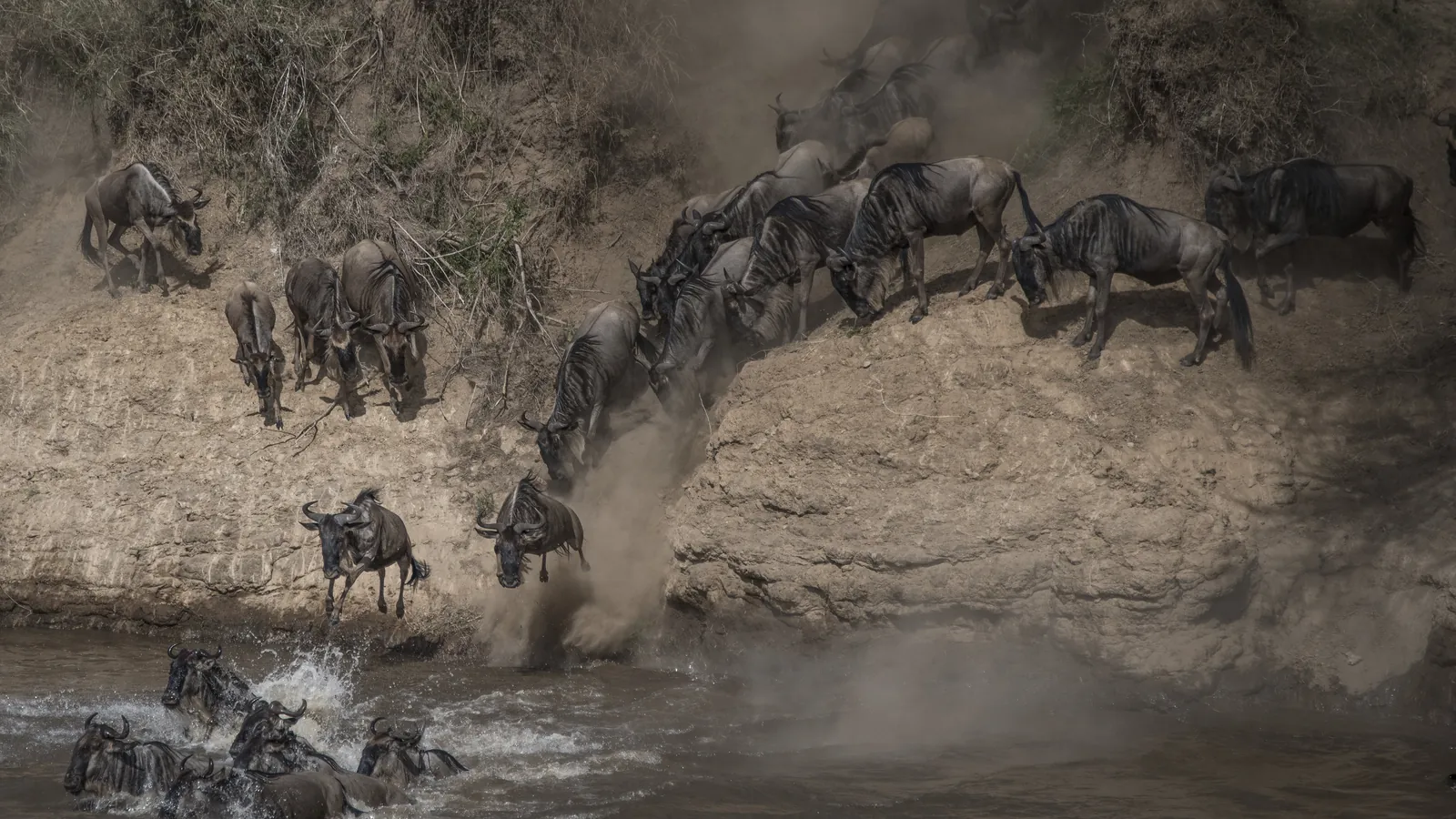
If the view alone is your goal, pair Amboseli with the rest of Kenya's highlights. Our Masai Mara safari guide covers the country's best-known reserve, and the Great Migration guide explains when the wildebeest crossings usually happen, which helps if you want to time Amboseli and the Mara in one trip. For more ideas, including activities beyond game drives, see our round-up of things to do in Kenya, our list of places to visit in Kenya and the sample routes in our Kenya itinerary guide.

If you are leaning towards the climb, read our guide to things to do in Tanzania, which shows what else is close to Moshi and Arusha, from wildlife parks to Zanzibar.

Getting there from Kathmandu

There are no non-stop flights from Kathmandu to Nairobi; flydubai states this on its route page, and Qatar Airways describes its Kathmandu to Nairobi service as stopping in Doha. In practice, travellers from Nepal usually connect through a hub such as Doha or Dubai to reach Nairobi for Amboseli, and climbers heading straight to the mountain look for connections into Kilimanjaro International Airport. Checked: October 2026, flydubai and Qatar Airways route pages. Schedules change by season, so check current routings before you plan.

Crossing into Tanzania: what to check

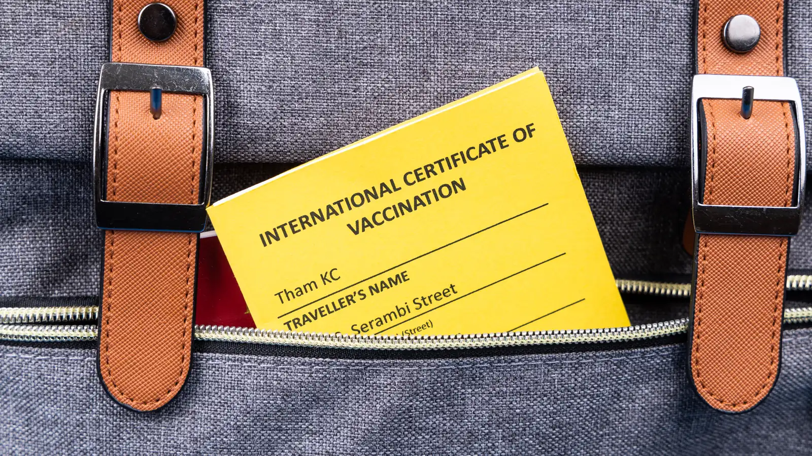
Crossing into Tanzania for a climb is an entry-rules question for your passport, so we do not cover it here; check the current entry rules for your passport on our Kenya visa page and the visa hub before you plan the border crossing. Health entry requirements matter too: see our guide to yellow fever vaccination for Kenya from Nepal, and ask your doctor about requirements for Tanzania as well.

Notes for families, couples and the diaspora

  • Families with children or elderly parents: the view from Amboseli is the realistic goal. It needs no fitness beyond a short walk up Observation Hill, and two nights in the park is relaxed. Our article on whether Kenya is safe to visit covers the practical safety questions families ask.
  • Couples: a balloon flight at sunrise or a sundowner facing the mountain is a strong highlight; just do not plan your whole trip around one photograph.
  • Nepali diaspora in the Gulf, Europe or North America: starting from a Gulf city can mean fewer connections to Kenya and Tanzania than starting from Kathmandu, which can make a combined safari and climb more practical.
  • Vegetarian travellers: tell your lodge and your climbing operator in advance, so meals in the park and on the mountain can be planned around vegetarian or other dietary needs. Our guide to Kenyan food shows what to expect off the mountain.

For trips that include Amboseli and the Kilimanjaro view, see our Kenya tour packages; a climb on the Tanzanian side can be planned around them.

Frequently asked questions

Is Kilimanjaro in Kenya or Tanzania?

Kilimanjaro is in Tanzania. Kilimanjaro National Park lies in Kilimanjaro Region in north-eastern Tanzania, close to the Kenya border, and its headquarters is at Marangu near Moshi. The best-known photographs are taken from Kenya's Amboseli National Park, which is why many people assume the mountain is Kenyan.

Can you see Kilimanjaro from Kenya?

Yes. Amboseli National Park in southern Kenya has the classic view of Kilimanjaro across the plains. The Kenya Wildlife Service says the mountain is clearly visible on clear days in the early morning and afternoon. Cloud often hides the summit at other times, so stay at least two nights to improve your chances.

What is the best time to see Kilimanjaro from Amboseli?

The best time to see Kilimanjaro from Amboseli is early morning and afternoon, the windows the Kenya Wildlife Service gives for clear days, ideally in Kenya's drier months: roughly January to February and June to September. The Long Rains of March to May and the Short Rains of October to December bring more cloud, though clear mornings still happen.

How high is Mount Kilimanjaro?

Mount Kilimanjaro is 5,895 m high at Uhuru Peak, the summit of Kibo, according to Tanzania National Parks (TANAPA) and the UNESCO World Heritage listing. That makes it the highest point in Africa. The Kenya Wildlife Service page for Amboseli gives 5,896 m, a one-metre difference; we use the TANAPA figure.

Is Kilimanjaro harder than Everest Base Camp?

Kilimanjaro is usually harder on the body than Everest Base Camp, though not more technical. Its summit at 5,895 m is about 500 m higher than Everest Base Camp, and most routes reach it in 5 to 8 days, faster than a typical base camp trek. Published studies record high rates of altitude sickness on Kilimanjaro, especially on short itineraries.

How many days does it take to climb Kilimanjaro?

Climbing Kilimanjaro takes 5 to 8 days to the summit area depending on the route, according to TANAPA, plus the descent. TANAPA notes that more days give a better chance of reaching the top, and published studies agree that longer Kilimanjaro itineraries reduce altitude sickness and improve summit success.

Do you need a guide to climb Kilimanjaro?

Yes. TANAPA states that all Kilimanjaro climbs must be guided by a licensed operator and that solo trekking is not permitted; tented camps on most routes are run by licensed operators. Checked: October 2026, TANAPA visitor guide.

Can you climb Kilimanjaro from Kenya?

No. You can see Kilimanjaro from Kenya, but every climbing route starts from a gate on the Tanzanian side, such as Marangu, Machame, Lemosho via Londorossi, or Rongai in the north. To climb Kilimanjaro you must enter Tanzania; check the entry rules for your passport before planning the border crossing.

What is the best month to climb Kilimanjaro?

The best months to climb Kilimanjaro are in the drier windows between the rains: roughly January to early March and June to September or early October. The Tanzania Meteorological Authority's long Masika rains fall from about mid-March to May and the shorter Vuli rains from about October to December, when Kilimanjaro trails are wetter and cloudier.

Are Kilimanjaro's glaciers disappearing?

Yes. Peer-reviewed studies found that about 85% of Kilimanjaro's 1912 ice cover had gone by the late 2000s, and a 2013 study judged it highly unlikely the ice would last beyond 2060 under current conditions. A 2022 UNESCO and IUCN report said Kilimanjaro's glaciers will very likely disappear by 2050.

Kilimanjaro kun desh ma cha?

Kilimanjaro is in Tanzania (Tanzania ma cha), in north-eastern Tanzania near the Kenya border. Nepali travellers usually see Kilimanjaro from Amboseli National Park in Kenya, but climbing it means travelling into Tanzania and starting from a TANAPA gate near Moshi or Arusha.
Tags
KenyaKilimanjaroAmboseliTanzaniaTrekking
Share
G
Gomayu Team
Writer at Gomayu
Keep reading
Blog / Kenya
Mount Kilimanjaro from Kenya: Amboseli Views and Climb Basics
26 min read 29 Oct 2026
Snow capped Mount Kilimanjaro rising above acacia plains and grazing zebras in southern Kenya

Short answer: Mount Kilimanjaro stands in northern Tanzania, just south of the Kenya border, but the classic view of Kilimanjaro is from Kenya's Amboseli National Park, where the snow-capped summit rises behind herds of elephants. You see it best on clear days in the early morning and in the afternoon, and more often in the drier months between the rains. You cannot climb it from Kenya, though: every climbing route starts from a gate on the Tanzanian side, so a climb means crossing the border.

This guide is written for two kinds of traveller. The first is the safari visitor who wants that famous photograph of Kilimanjaro above the plains of Amboseli. The second is the Himalayan trekker, often from Nepal, who has walked to Everest Base Camp or Annapurna and wonders whether Africa's highest mountain is the next step. We cover where the mountain is, when and where you can see it from Kenya, how a climb compares with a Nepal trek, which routes exist, and how a climb can fit around a Kenya safari.

If you are still building the bigger picture of the country, start with our complete Kenya travel guide and come back here for the mountain.

Quick factAnswerSource
CountryTanzania (Kilimanjaro National Park, Kilimanjaro Region)Tanzania National Parks (TANAPA)
Summit height5,895 m at Uhuru Peak on KiboTANAPA; UNESCO World Heritage listing
Best place to see it from KenyaAmboseli National Park, southern KenyaKenya Wildlife Service (KWS)
When it is clearestClear days, early mornings and afternoonsKWS
Can you climb from Kenya?No. All climbing gates are on the Tanzanian sideTANAPA visitor guide
Typical climb length5 to 8 days to the summit area, depending on routeTANAPA
Guide needed?Yes. All climbs must be guided by a licensed operator; solo trekking is not permittedTANAPA visitor guide

Where is Mount Kilimanjaro?

Snow capped summit of Mount Kilimanjaro rising above a band of clouds in Tanzania

Mount Kilimanjaro is in north-eastern Tanzania, close to the border with Kenya, inside Kilimanjaro National Park. The park headquarters is at Marangu in the Moshi District of Kilimanjaro Region, and the nearest international airport is Kilimanjaro International Airport (JRO), about 40 km from the park according to Tanzania National Parks (TANAPA).

The confusion about which country it belongs to is understandable. Most of the famous photographs of Kilimanjaro are taken from Kenya, looking south across Amboseli. The mountain itself, however, is entirely Tanzanian. UNESCO, which inscribed Kilimanjaro National Park as a World Heritage Site in 1987, describes it as a volcanic massif that "stands in splendid isolation above the surrounding plains", with its snowy peak looming over the savannah. UNESCO puts the rise at 4,877 m above the surrounding plains, and that isolation is why it dominates the horizon from so far away in Kenya.

What exactly is "Kilimanjaro"?

Kilimanjaro is not a single cone but a massif. TANAPA describes it as two dormant volcanoes and one extinct one:

PeakHeight (TANAPA)What it is
Kibo (Uhuru Peak is its summit)5,895 mDormant volcano; the highest point in Africa and the goal of almost every climb
Mawenzi5,149 mDormant volcano; a jagged, rocky peak to the east of Kibo
Shira3,962 mExtinct volcano; the Shira Plateau on the western side, which TANAPA describes as a vast high caldera of moorland, carries its name

TANAPA says the name is often explained as a mix of the Swahili word kilima (mountain) and the KiChagga word njaro, loosely "whiteness", giving "White Mountain", although it also notes that the true origin is not well known.

A simple location note for readers in Nepal

Picture Kenya and Tanzania side by side on the east coast of Africa. Nairobi, Kenya's capital, sits in the south-central part of the country. Amboseli is about 200 km from Nairobi by road, according to the Kenya Wildlife Service, in the far south near the Tanzanian border. Kilimanjaro rises just across that border. The towns climbers use as bases, Moshi and Arusha, are on the Tanzanian side and are served by Kilimanjaro International Airport and Arusha Airport. So the view is Kenyan; the mountain and the climb are Tanzanian. Our Tanzania travel guide covers that side of the border in detail.

Can you see Kilimanjaro from Kenya?

Yes, you can see Kilimanjaro from Kenya, and Amboseli National Park is the place to do it. The Kenya Wildlife Service says the Amboseli landscape is dominated by Mt. Kilimanjaro and the elephants gathering around the swamps, and that on clear days the mountain is clearly visible during early mornings and afternoons. The honest catch is the phrase "on clear days": on many days the upper mountain is wrapped in cloud.

Amboseli lies in southern Kenya, in Kajiado County, close to the Kenya and Tanzania border, and covers part of an ancient (Pleistocene) lake basin. KWS explains that water springs associated with Kilimanjaro give rise to several swamps in the park, such as Enkong Narok. That is the link between the mountain and the wildlife: water from Kilimanjaro feeds the swamps, the swamps draw the elephants, and the elephants stand in front of the mountain. Our full Amboseli National Park guide explains the park itself, its wildlife and where to stay.

Why the view is so dramatic

From Amboseli the ground is almost flat, and Kilimanjaro rises thousands of metres above it with no other mountains in front. Visitors who have seen the Himalaya from Nagarkot or Pokhara will notice the difference straight away. In Nepal, big peaks usually appear as one ridge among many. Kilimanjaro appears as a single, enormous dome on its own, with its summit ice catching the first and last light.

What you will not see from Kenya

Be realistic about what the view shows. From Amboseli you see the broad northern side of Kibo and, depending on your position and the cloud, Mawenzi's darker spires to the left. You do not see climbers, camps or trails, and the mountain is far enough away that a long lens helps for close photographs. It is quite possible to spend two days in Amboseli and never see the summit at all if cloud sits on it from morning to evening. Plan for at least two mornings in the park if the view matters to you.

Explore Kenya tour packages
View all →

When is the best time to see Kilimanjaro from Amboseli?

The best time to see Kilimanjaro from Amboseli is in the early morning and again in the afternoon, ideally during Kenya's drier months between the two rainy seasons. That is the pattern KWS gives for clear days. The rains matter because more rain usually means more cloud on the mountain.

The Kenya Meteorological Department describes two rainy seasons: the "Long Rains" of March, April and May, and the "Short Rains" of October, November and December. Kajiado County, where Amboseli is, falls in the department's South-eastern Lowlands region. Start and end dates shift every year, so treat the months as a guide rather than a timetable. Checked: October 2026, Kenya Meteorological Department seasonal forecasts.

Time of dayWhat to expectPractical tip
Early morningKWS names early mornings as a time the mountain is clearly visible on clear daysBe at your viewpoint or on the road as early as the park and your lodge allow
AfternoonKWS names afternoons as the second window on clear daysKeep the afternoon free and return to an open area with the mountain to the south
Season (Kenya Meteorological Department naming)Months, approximatelyChances of a Kilimanjaro view
Drier months after the Short RainsJanuary to FebruaryBetter: less rain usually means less cloud
Long RainsMarch to MayLower: the wettest season, with more cloud on the mountain
Drier months between the rainsJune to SeptemberBetter: less rain usually means less cloud
Short RainsOctober to DecemberMixed: more cloud than the dry months, but clear early mornings still happen

Check park opening hours and rules on driving inside the park with your lodge or driver guide before planning a very early or late drive. Management of Amboseli is also in transition: the national government handed day-to-day management to Kajiado County Government in November 2025, and in July 2026 Kenya's High Court temporarily halted the county takeover while the dispute is heard, so who runs the gates and what the rules are may change. Checked: October 2026, The Star (Kenya).

The Dashain and Tihar question

Many travellers from Nepal travel during the Dashain and Tihar holidays, which usually fall in October and November. That window overlaps the start of the Short Rains in southern Kenya. It does not rule out a view, and clear early mornings still happen in the rainy months. It does mean you should not plan a one-night visit to Amboseli and expect a guaranteed photograph. Two nights give you two mornings and two afternoons, which improves your odds. For a month-by-month view of the wider country, see our guide to the best time to visit Kenya.

How to improve your chances

  • Stay at least two nights. It doubles your viewing windows, and it is the factor you control most easily.
  • Check the sky at first light. If the summit is out, go straight to an open area; cloud can return quickly.
  • Keep the afternoon free. KWS names afternoons as the second clear window, so a hidden morning is not the end of your chances.
  • Bring a zoom lens or binoculars. The mountain is huge but far away.
  • Accept the weather. Nobody can promise a view of Kilimanjaro, including your guide or your lodge.

Where in Amboseli are the best views of Kilimanjaro?

The best views of Kilimanjaro in Amboseli come from Observation Hill, from the open plains and swamp edges around Ol Tukai and Enkong Narok, and, weather permitting, from the air on a balloon flight. KWS lists Observation Hill (also called Nomatior) as offering a panoramic view of the park, names Ol Tukai and the swamps among the park's main features, and points to Lemomo Hill, just outside the park, as a high viewpoint.

ViewpointWhy it worksBest timeGood to know
Observation Hill (Nomatior)A raised viewpoint with a panoramic view over the swamps and plains towards the mountainEarly morning or late afternoonKWS says the hike up is worth the effort
Enkong Narok and the permanent swampsKWS describes elephants congregating around the swamps, which puts wildlife in the foreground with Kilimanjaro behindEarly morning or afternoonA popular setting for "elephants and Kilimanjaro" photographs
Ol Tukai areaKWS calls it a cool oasis of trees favoured by elephants and lions; open ground nearby faces the mountainDawn and duskOl Tukai Lodge, one of the private lodges KWS lists, is in this area
Lemomo HillKWS calls it the highest observation point, with the best views of the parkClear morningsIt is in Kitenden conservancy, about 3 km outside the park boundary (KWS); ask your driver guide about access
Lake Amboseli (dry lake bed)Wide, flat foreground; KWS notes the lake floods in heavy rains and attracts flamingosEarly, before heat hazeKWS describes it as a temporary lake, so expect a dry bed outside heavy rains
Balloon safariAn aerial view across the plains with the mountain in the distanceSunrise flightsKWS lists balloon safaris among park activities; availability depends on operators and weather

Observation Hill in more detail

Observation Hill is a popular stop and a good place to orient yourself. From the top you look over the green swamps, the pale dry lake bed and the scattered herds, with Kilimanjaro filling the southern sky on a clear day. It is also a chance to stretch your legs after hours of viewing from a vehicle. Bring water and a hat for the walk up. Follow your driver guide and the KWS rangers on where you may walk.

Getting to Amboseli for the view

KWS gives three main access gates: Iremito, Kimana and Meshanani. From Nairobi it lists 204 km via Emali to Iremito Gate on the Nairobi to Mombasa road, and 220 km via Namanga to Meshanani Gate, tarmac to Namanga and murram (gravel) after that. There is also a tarmacked airstrip, Kimana, for light aircraft. Checked: October 2026, Kenya Wildlife Service. Many visitors arrive by road from Nairobi as part of a wider safari circuit; our Nairobi travel guide helps with the start of the trip.

How hard is a Kilimanjaro climb for someone who has trekked in Nepal?

For a fit trekker who has already been to Everest Base Camp, a Kilimanjaro climb is not technically harder, but it is often harder on the body because you go higher, faster. The summit, at 5,895 m, is roughly 500 m above Everest Base Camp, and most Kilimanjaro routes reach it in 5 to 8 days, while a typical Everest Base Camp trek spends more days climbing to a lower top. There is no rock climbing or ropework on the standard routes. The challenge is altitude, cold and the long summit day.

Kilimanjaro vs Everest Base Camp: the altitude comparison

The table puts the two side by side. Kilimanjaro heights come from TANAPA where it gives them; camp and hut heights come from published altitude studies, because TANAPA does not list them on its park pages. Everest Base Camp moves with the Khumbu Glacier, so published studies give heights from about 5,300 m to 5,400 m; the CDC Yellow Book uses "approximately 5,400 m" for Everest base camp and "approximately 5,900 m" for Kilimanjaro.

PlaceApproximate altitudeSource
KathmanduAbout 1,300 to 1,400 mPublished altitude studies (several use 1,300 m or 1,400 m)
Moshi, Tanzania (climbing base town)About 950 mPublished Kilimanjaro study (Respiratory Physiology and Neurobiology, 2018)
Namche Bazaar, NepalAbout 3,440 mPublished Everest trek study (Frontiers in Genetics, 2019)
Shira Camp, KilimanjaroAbout 3,505 mPublished Kilimanjaro study, 2018
Kibo Hut, Kilimanjaro (Marangu route)About 4,730 mPublished Kilimanjaro study (High Altitude Medicine and Biology, 2010)
Barafu Camp, Kilimanjaro (common high camp)About 4,837 mPublished Kilimanjaro study, 2018
Gorak Shep, NepalAbout 5,160 mPublished Everest trek study, 2019
Everest Base Camp, NepalAbout 5,300 to 5,400 m (the camp sits on a moving glacier)CDC Yellow Book; published studies
Uhuru Peak, Kilimanjaro summit5,895 mTANAPA; UNESCO

Why the faster ascent matters

The CDC's guidance for travellers is that once you are above 3,000 m you should raise your sleeping altitude by no more than 500 m a day, and add an extra acclimatisation day for every additional 1,000 m of sleeping altitude gained. Many Kilimanjaro itineraries go faster than that, especially the shorter versions of the routes, and then make a summit push of well over 1,000 m from the high camp.

The research on Kilimanjaro is sobering. A study of 312 trekkers on the Marangu route, published in Wilderness and Environmental Medicine, recorded acute mountain sickness (AMS) in 77% of those with complete data, and a summit rate of 61%. Its authors concluded that the risk of AMS on Kilimanjaro is high and that trekkers ideally need a more gradual route profile. A smaller study on the six-day Machame route found AMS on summit day in 86% of 28 trekkers. A study of 175 trekkers on a six-day Rongai ascent recorded a lower AMS rate and an 88% summit rate than earlier work on four and five-day ascents. The pattern is consistent: more days on the mountain means better acclimatisation and a better chance of reaching the top.

Does your Nepal experience help?

Yes, with limits. The CDC says that how you previously responded to high altitude is the most reliable guide for future trips, but only when the altitude and ascent rate are similar, and even then it is not a perfect predictor. If you walked to Everest Base Camp slowly and felt well, that is encouraging; it does not prove you will feel well on a faster, higher Kilimanjaro ascent. The Edinburgh study of Kilimanjaro climbers also found significantly less AMS among people who were already acclimatised before the climb, which is a point in favour of arriving from a high place rather than straight from sea level. The CDC suggests that spending two or more nights above 2,750 m before a trip is useful preparation; Kathmandu, at around 1,300 to 1,400 m, is well below that, so time in the hills matters more than time in the city.

FactorEverest Base Camp trek (Nepal)Kilimanjaro climb (Tanzania)
Highest pointAbout 5,300 to 5,400 m at base camp5,895 m at Uhuru Peak
Ascent profileUsually gradual, with acclimatisation days on the way upUsually faster; 5 to 8 days to the summit depending on route (TANAPA)
Summit dayA walk to base camp and back to Gorak Shep, in daylightA long push of over 1,000 m from the high camp to the summit, followed by a long descent; ask your operator what time it starts
Technical difficultyNon-technical trekkingNon-technical on the standard routes
AccommodationTeahouses and lodgesHuts on the Marangu route; tented camps on other routes (TANAPA)
Guide rulesSet by Nepal's authorities; check current trekking rulesAll climbs guided by a licensed operator; no solo trekking (TANAPA)
Climate zonesForest to high alpineUNESCO describes five main vegetation zones, from the lower slopes through forest and moorland to alpine desert and the summit

Practical points for Himalayan trekkers

  • Choose more days, not fewer. The studies above all point the same way. If an itinerary looks fast, ask how many nights you sleep above 3,500 m before the summit night.
  • Expect a long, cold summit day. TANAPA highlights the famous sunrises from Uhuru Peak, and its safety advice is to carry proper cold-weather and rain gear, a headlamp and personal medicines. Ask your operator what time the summit push starts and pack for the coldest conditions of the trip.
  • Know the warning signs. The CDC's advice is simple: descend if symptoms get worse despite rest or treatment at the same altitude.
  • Talk to a doctor before you go. Medicines for altitude sickness are prescription decisions. The CDC notes that some climbers use preventive medication for summit day on peaks like Kilimanjaro; that is a conversation for your doctor, not a blog.
  • Check your insurance covers high-altitude trekking. Some policies set an altitude limit or exclude high-altitude trekking. Our guide to travel insurance from Nepal explains what to look for.
  • Older climbers and parents. A small 2018 study of an 11-day Kilimanjaro trek found that mild lung fluid at the high camp tended to be more common in older adults than younger ones, though the difference was not statistically significant and the fluid stayed subclinical. The six-day Rongai study above also found that trekkers aged 40 and over reached the summit less often. Age is not a bar, but older family members should get a medical check and choose a longer route.

Which Kilimanjaro climbing routes are there?

TANAPA says six mountain trails lead to the summit of Kilimanjaro and that reaching Kibo takes 5 to 8 days depending on the route, adding that "the more days, the higher the possibility to conquer the summit". Its visitor guide names the main gates as Marangu, Machame, Lemosho (reached via Londorossi) and Rongai in the north, with Mweka Gate used for the descent. Checked: October 2026, TANAPA.

Routes can close at short notice. In late September 2026 TANAPA temporarily suspended the Lemosho and Londorossi routes because of a wildfire on the western slopes, as reported by Tanzania's Daily News, and announced their reopening on 8 October 2026. Ask your operator to confirm that your route is open before you travel.

The routes below are the ones named by TANAPA's visitor guide. Durations vary by operator and by how many acclimatisation days you add, so we show TANAPA's overall range and, where we found one, the ascent length used in a published study. We have not invented day counts where no reliable source gave one.

RouteStarts fromNights on the mountain inDays (sourced)Character
MaranguMarangu Gate, south-eastAlpine huts: Mandara, Horombo, Kibo (TANAPA)4 or 5-day ascents in one published study; longer versions add a rest dayThe only hut route; the fast versions studied showed a high AMS rate
MachameMachame Gate, south-westTented camps6-day version studied in published researchIncludes a 'sleep low' night after climbing higher on day three, as described in the published study
LemoshoLemosho, reached via Londorossi, westTented camps; crosses the Shira PlateauWithin TANAPA's 5 to 8-day rangeLong western approach across the Shira Plateau, which TANAPA describes as a high caldera of moorland
RongaiNorthern side (TANAPA)Tented camps6-day ascent in one published studyApproaches from the north, the side of the mountain that faces Kenya
MwekaMweka Gate, southDescent onlyNot an ascent routeTANAPA says Mweka Gate is used for the descent

TANAPA counts six trails in all, but its park pages name only the gates above. Operators sell further route names and variations; treat the descriptions here as a guide and confirm current routes and rules with a licensed operator before you book.

Which route suits a Nepal trekker?

If you have done Everest Base Camp, the Annapurna Circuit or a similar trek, you will be comfortable with the daily walking on any of these routes. The bigger question is how quickly you gain height. Longer itineraries, with extra nights before the summit push, give more time to adjust, and the published research suggests that is what improves both comfort and summit success. If you prefer a roof over your head and a lodge feel closer to a Nepal teahouse, Marangu's huts are the nearest thing, but choose a version with an extra acclimatisation day.

The climbing season

Kilimanjaro is open all year; TANAPA describes the park as open year-round. The Tanzania Meteorological Authority places Kilimanjaro Region in the North Eastern Highlands, one of its "bimodal" areas with two rainy seasons: the heavier Masika rains from about mid-March to May, and the shorter Vuli rains from about October to December. The drier windows between them, roughly January to early March and June to September or early October, are the usual climbing seasons. TANAPA's safety advice to carry cold-weather and rain gear applies in every month.

PeriodRain pattern (Tanzania Meteorological Authority)What it means for a climb
January to early MarchBetween the two rainy seasonsA common choice for climbs
Mid-March to MayMasika, the long and heavier rainsWettest and quietest; muddy forest trails and more cloud
June to SeptemberGenerally dryA common choice for climbs; pack for cold nights
October to DecemberVuli, the shorter rainsPossible but more variable; expect wetter trails and more cloud

The shrinking ice on the summit

TANAPA describes Kibo as snow-covered all year, and the summit ice fields such as the Furtwängler and Rebmann glaciers are still there. They are shrinking fast. A 2009 study in the Proceedings of the National Academy of Sciences found that 85% of the ice cover present in 1912 had disappeared, and 26% of the ice present in 2000 was gone by 2007. A 2013 mapping study in The Cryosphere measured the ice area at 11.40 square kilometres in 1912 and 1.76 square kilometres in 2011, again about 85% lost, and judged it highly unlikely that the ice would persist beyond 2060 if current conditions continue. A 2022 report by UNESCO and IUCN said glaciers in all African World Heritage sites, including Kilimanjaro National Park, will very likely be gone by 2050.

For travellers this has two practical meanings. The white summit you see from Amboseli is smaller than in older photographs, and it will not look the same in a few decades. And if seeing ice on Africa's highest mountain matters to you, there is no reason to put the trip off.

How do you combine Kilimanjaro with a Kenya safari?

Safari vehicle and two travellers beside a lone acacia tree on the open plains of Kenya

The simplest way to combine Kilimanjaro with a Kenya safari is to see the mountain from Amboseli on the Kenyan side, and, if you also want to climb, add a separate climb in Tanzania before or after the safari. Amboseli gives you the view without any border crossing. A climb means entering Tanzania and starting from one of TANAPA's gates, usually from Moshi or Arusha.

Three ways to build the trip

Two safari vehicles spaced far apart on open golden savannah under a wide Kenyan sky
OptionWho it suitsWhat it involvesHonest downside
View only: Amboseli as part of a Kenya safariFamilies, couples, first-time safari travellers, elderly parentsTwo nights in Amboseli inside a wider route with the Masai Mara or other parksA view is never guaranteed; cloud can hide the mountain for days
Climb first, then safariTrekkers who want to rest and celebrate afterwardsFly into the Kilimanjaro side, climb, then cross to Kenya for the safariTired legs on long game drives; plan a rest day
Safari first, then climbTravellers who want the climb as the finaleKenya safari ending near Amboseli, then cross into Tanzania for the climbEasy to underestimate how much the climb needs rest and preparation beforehand

If the view alone is your goal, pair Amboseli with the rest of Kenya's highlights. Our Masai Mara safari guide covers the country's best-known reserve, and the Great Migration guide explains when the wildebeest crossings usually happen, which helps if you want to time Amboseli and the Mara in one trip. For more ideas, including activities beyond game drives, see our round-up of things to do in Kenya, our list of places to visit in Kenya and the sample routes in our Kenya itinerary guide.

If you are leaning towards the climb, read our guide to things to do in Tanzania, which shows what else is close to Moshi and Arusha, from wildlife parks to Zanzibar.

Getting there from Kathmandu

There are no non-stop flights from Kathmandu to Nairobi; flydubai states this on its route page, and Qatar Airways describes its Kathmandu to Nairobi service as stopping in Doha. In practice, travellers from Nepal usually connect through a hub such as Doha or Dubai to reach Nairobi for Amboseli, and climbers heading straight to the mountain look for connections into Kilimanjaro International Airport. Checked: October 2026, flydubai and Qatar Airways route pages. Schedules change by season, so check current routings before you plan.

Crossing into Tanzania: what to check

Crossing into Tanzania for a climb is an entry-rules question for your passport, so we do not cover it here; check the current entry rules for your passport on our Kenya visa page and the visa hub before you plan the border crossing. Health entry requirements matter too: see our guide to yellow fever vaccination for Kenya from Nepal, and ask your doctor about requirements for Tanzania as well.

Notes for families, couples and the diaspora

  • Families with children or elderly parents: the view from Amboseli is the realistic goal. It needs no fitness beyond a short walk up Observation Hill, and two nights in the park is relaxed. Our article on whether Kenya is safe to visit covers the practical safety questions families ask.
  • Couples: a balloon flight at sunrise or a sundowner facing the mountain is a strong highlight; just do not plan your whole trip around one photograph.
  • Nepali diaspora in the Gulf, Europe or North America: starting from a Gulf city can mean fewer connections to Kenya and Tanzania than starting from Kathmandu, which can make a combined safari and climb more practical.
  • Vegetarian travellers: tell your lodge and your climbing operator in advance, so meals in the park and on the mountain can be planned around vegetarian or other dietary needs. Our guide to Kenyan food shows what to expect off the mountain.

For trips that include Amboseli and the Kilimanjaro view, see our Kenya tour packages; a climb on the Tanzanian side can be planned around them.

Frequently asked questions

Is Kilimanjaro in Kenya or Tanzania?

Kilimanjaro is in Tanzania. Kilimanjaro National Park lies in Kilimanjaro Region in north-eastern Tanzania, close to the Kenya border, and its headquarters is at Marangu near Moshi. The best-known photographs are taken from Kenya's Amboseli National Park, which is why many people assume the mountain is Kenyan.

Can you see Kilimanjaro from Kenya?

Yes. Amboseli National Park in southern Kenya has the classic view of Kilimanjaro across the plains. The Kenya Wildlife Service says the mountain is clearly visible on clear days in the early morning and afternoon. Cloud often hides the summit at other times, so stay at least two nights to improve your chances.

What is the best time to see Kilimanjaro from Amboseli?

The best time to see Kilimanjaro from Amboseli is early morning and afternoon, the windows the Kenya Wildlife Service gives for clear days, ideally in Kenya's drier months: roughly January to February and June to September. The Long Rains of March to May and the Short Rains of October to December bring more cloud, though clear mornings still happen.

How high is Mount Kilimanjaro?

Mount Kilimanjaro is 5,895 m high at Uhuru Peak, the summit of Kibo, according to Tanzania National Parks (TANAPA) and the UNESCO World Heritage listing. That makes it the highest point in Africa. The Kenya Wildlife Service page for Amboseli gives 5,896 m, a one-metre difference; we use the TANAPA figure.

Is Kilimanjaro harder than Everest Base Camp?

Kilimanjaro is usually harder on the body than Everest Base Camp, though not more technical. Its summit at 5,895 m is about 500 m higher than Everest Base Camp, and most routes reach it in 5 to 8 days, faster than a typical base camp trek. Published studies record high rates of altitude sickness on Kilimanjaro, especially on short itineraries.

How many days does it take to climb Kilimanjaro?

Climbing Kilimanjaro takes 5 to 8 days to the summit area depending on the route, according to TANAPA, plus the descent. TANAPA notes that more days give a better chance of reaching the top, and published studies agree that longer Kilimanjaro itineraries reduce altitude sickness and improve summit success.

Do you need a guide to climb Kilimanjaro?

Yes. TANAPA states that all Kilimanjaro climbs must be guided by a licensed operator and that solo trekking is not permitted; tented camps on most routes are run by licensed operators. Checked: October 2026, TANAPA visitor guide.

Can you climb Kilimanjaro from Kenya?

No. You can see Kilimanjaro from Kenya, but every climbing route starts from a gate on the Tanzanian side, such as Marangu, Machame, Lemosho via Londorossi, or Rongai in the north. To climb Kilimanjaro you must enter Tanzania; check the entry rules for your passport before planning the border crossing.

What is the best month to climb Kilimanjaro?

The best months to climb Kilimanjaro are in the drier windows between the rains: roughly January to early March and June to September or early October. The Tanzania Meteorological Authority's long Masika rains fall from about mid-March to May and the shorter Vuli rains from about October to December, when Kilimanjaro trails are wetter and cloudier.

Are Kilimanjaro's glaciers disappearing?

Yes. Peer-reviewed studies found that about 85% of Kilimanjaro's 1912 ice cover had gone by the late 2000s, and a 2013 study judged it highly unlikely the ice would last beyond 2060 under current conditions. A 2022 UNESCO and IUCN report said Kilimanjaro's glaciers will very likely disappear by 2050.

Kilimanjaro kun desh ma cha?

Kilimanjaro is in Tanzania (Tanzania ma cha), in north-eastern Tanzania near the Kenya border. Nepali travellers usually see Kilimanjaro from Amboseli National Park in Kenya, but climbing it means travelling into Tanzania and starting from a TANAPA gate near Moshi or Arusha.
Tags
KenyaKilimanjaroAmboseliTanzaniaTrekking
Share
G
Gomayu Team
Writer at Gomayu
Keep reading